
HELLENIC REPUBLIC
MINISTRY OF CULTURE
GENERAL DIRECTORATE OF ANTIQUITIES
AND CULTURAL HERITAGE
EPHORATE OF ANTIQUITIES OF ACHAEA


Architectural Heritage – Bridging the past with the future
26 – 28 September 2025
The brick city–wall of Dyme: Gazing at Europe
Despite their diversity, European peoples have at the same time common cultural origins that ensure cohesion within the European Union. As bearers of a unified culture, they gain awareness that extends beyond national and European boundaries, enabling them to set common goals and cooperate seamlessly. Architectural monuments, as one of the main segments of the cultural heritage of a place, contribute to the preservation of historical memory and the strengthening of the cultural identity of Europe. So when we conserve and reconstruct the ancient walls, we do so in order to look beyond the horizon at our common future.
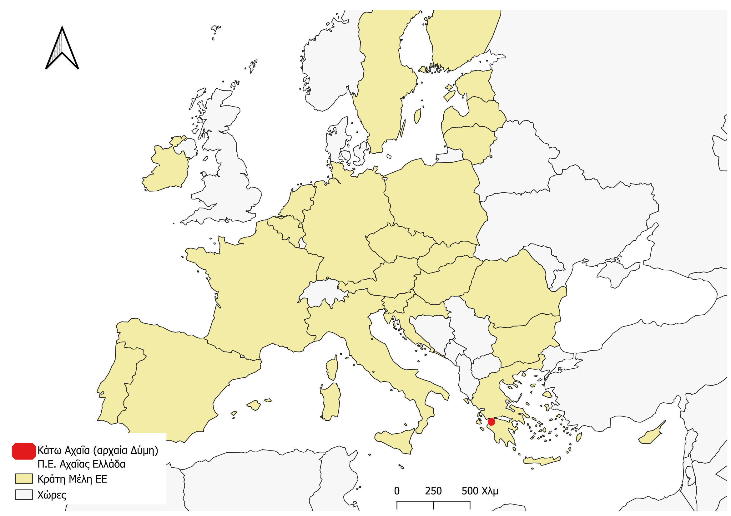
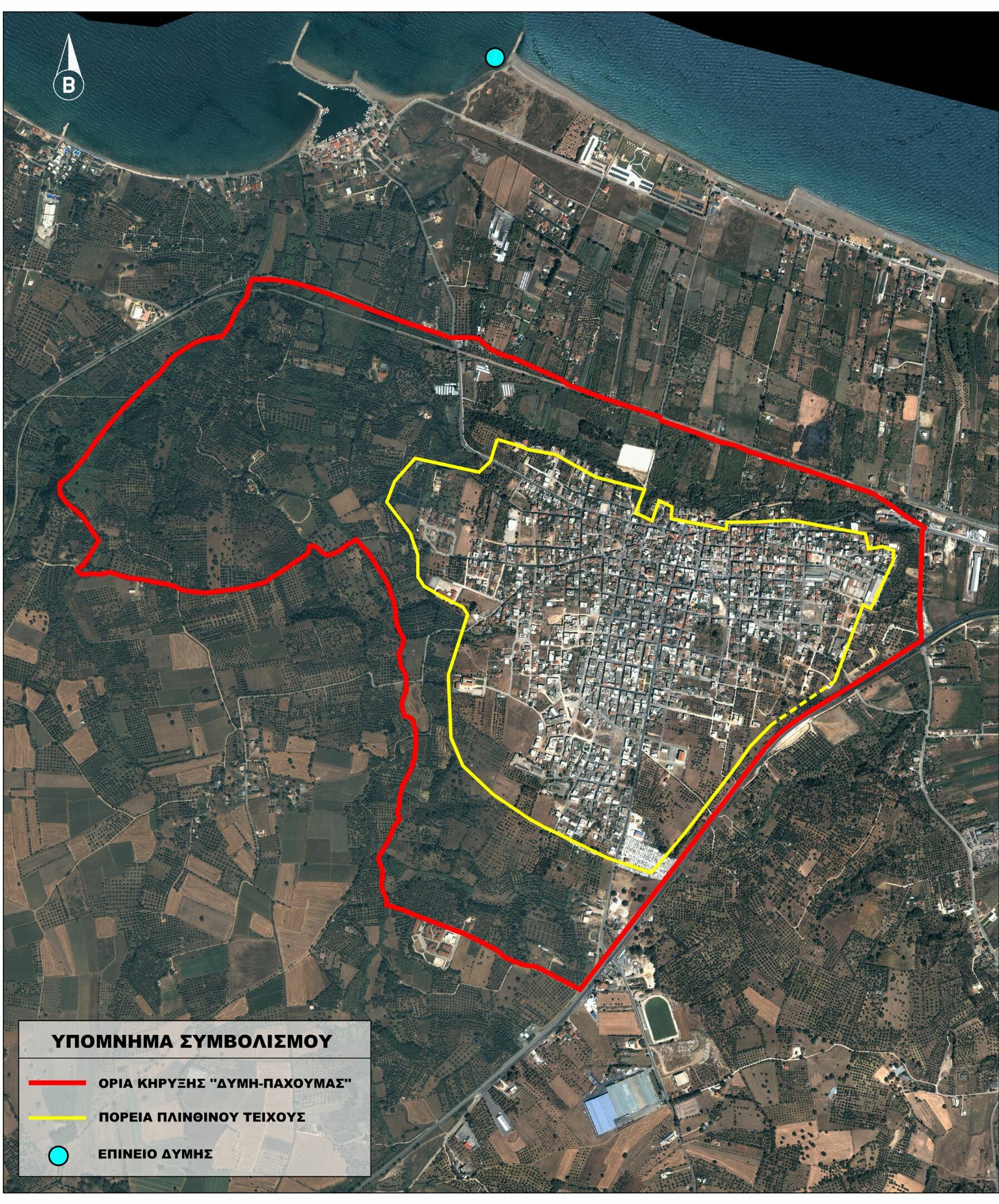
The ancient city of Dyme developed on the same natural plateau that the modern town of Kato Achaea occupies today, 22 km west of Patras, in the Regional Unit of Achaea. The digital exhibition of the relatively unknown monument in a lesser-known destination in Greece presents the past in an attractive and comprehensive way to the general public, aiming to serve as a starting point for exploring the ancient city and a means of raising awareness for its rescue and protection. The wall of Dyme is a powerful symbol of collective identity, based on participation in a shared knowledge and memory, and an element of timelessness that transfers new meanings to the reading of ancient life. Its construction was necessary for the existence and autonomy of the ancient city-state, protecting it from those who plotted against it. Today, free from its original purpose, it is approached as an element of cultural identity, interconnection and unity.
The course of the wall
The journey begins
Kato Achaea is part of the unified declared archaeological site “Dyme-Pachoumas” (Government Gazette 43/A.A.P./15-3-2018).[1] The brick wall of ancient Dyme, a large and costly public project, has a length of approximately 5 km and enclosed a large residential area providing security to its inhabitants. Its erection dates to the early Hellenistic period, around the end of the 4th century BC
[1] Drawings and photographs credited to the archive of the Ephorate of Antiquities of Achaea.
The sites where the fortification was found were gradually revealed in recent decades through rescue excavations conducted by the Ephorate of Antiquities of Achaea and are numbered (nos. 1-16) within an explanatory symbol. The development of the course of the wall is delimited based on the parts identified so far, adapting to the natural terrain. In terms of construction, the wall features independent sections that enable its autonomous function, adaptation, and harmonious integration at the edge of the plateau.
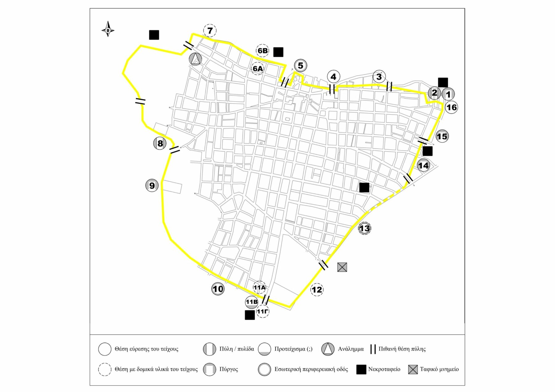
The modern city of Kato Achaea, the seat of the Municipality of Western Achaea, linked to the location and morphology of the site, preserves elements from the urban layout of the ancient city-state with the boundaries of their urban layout almost coinciding. The communication and supply needs within the broader Chora (territory) of Dyme and the access to the cemeteries stretching alongside the streets and outside the walls were served through gates of the wall that seem to have been placed at unequal distances, following the natural terrain. The towers of the fortification protected, in addition to the gates, the curving points.
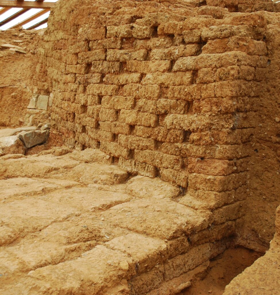
The primary core of the wall, superstructure and foundation, was built entirely of mud-bricks, which were produced at low cost and they ensured fast completion of the project, durability in the event of attack with siege engines, and quick restoration in case of damage. In most of the revealed sections, the mud-brick body is lined on the base along the inner side with a stone-built front showing variations. A prerequisite for the protection and preservation of the brick wall from the corrosive effect of water is the existence of a tiled roof
The abundance of suitable soil in Dyme favoured the construction of mud-bricks, the predominantly structural material of the area, as evidenced by the excavation finds.
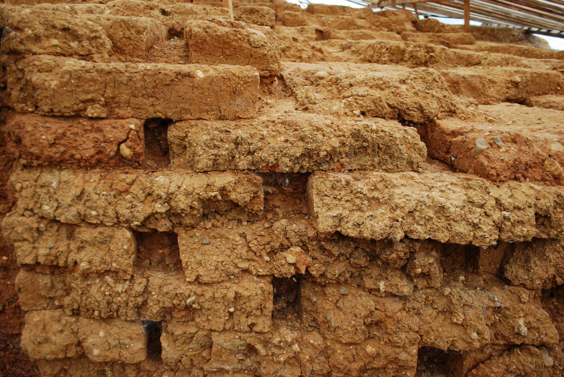
Τhe mudbrick body
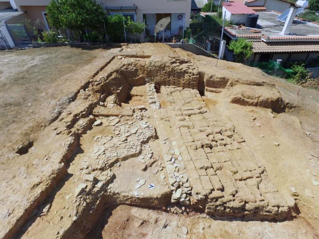
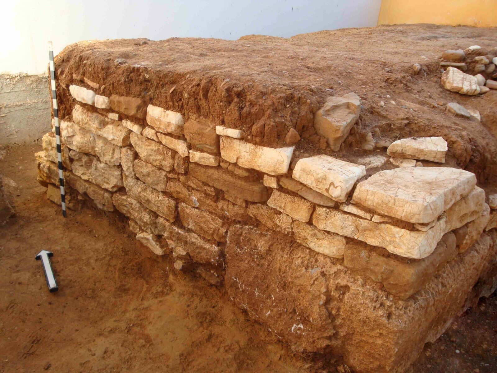
On site 1, the revealed part of the fortification dates to the era of the overall construction of city walls. It was revealed at a maximum length of 13 m and at a height of 0.60 to 1.85 m, with 8 to 21 courses of mud-bricks, respectively. It is 2.90 m wide. A stone wall, 0.50 m
wide and 0.65 m high, frames internally the foundation of the brick body. It consists of dry, conglomerate, white limestone (from Araxos), sandstone, fragments of rock, as well as breccia, relatively small in size and roughly dressed.
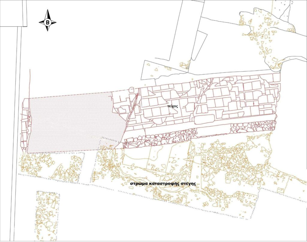
The destruction layer of the roof stretches along its course.
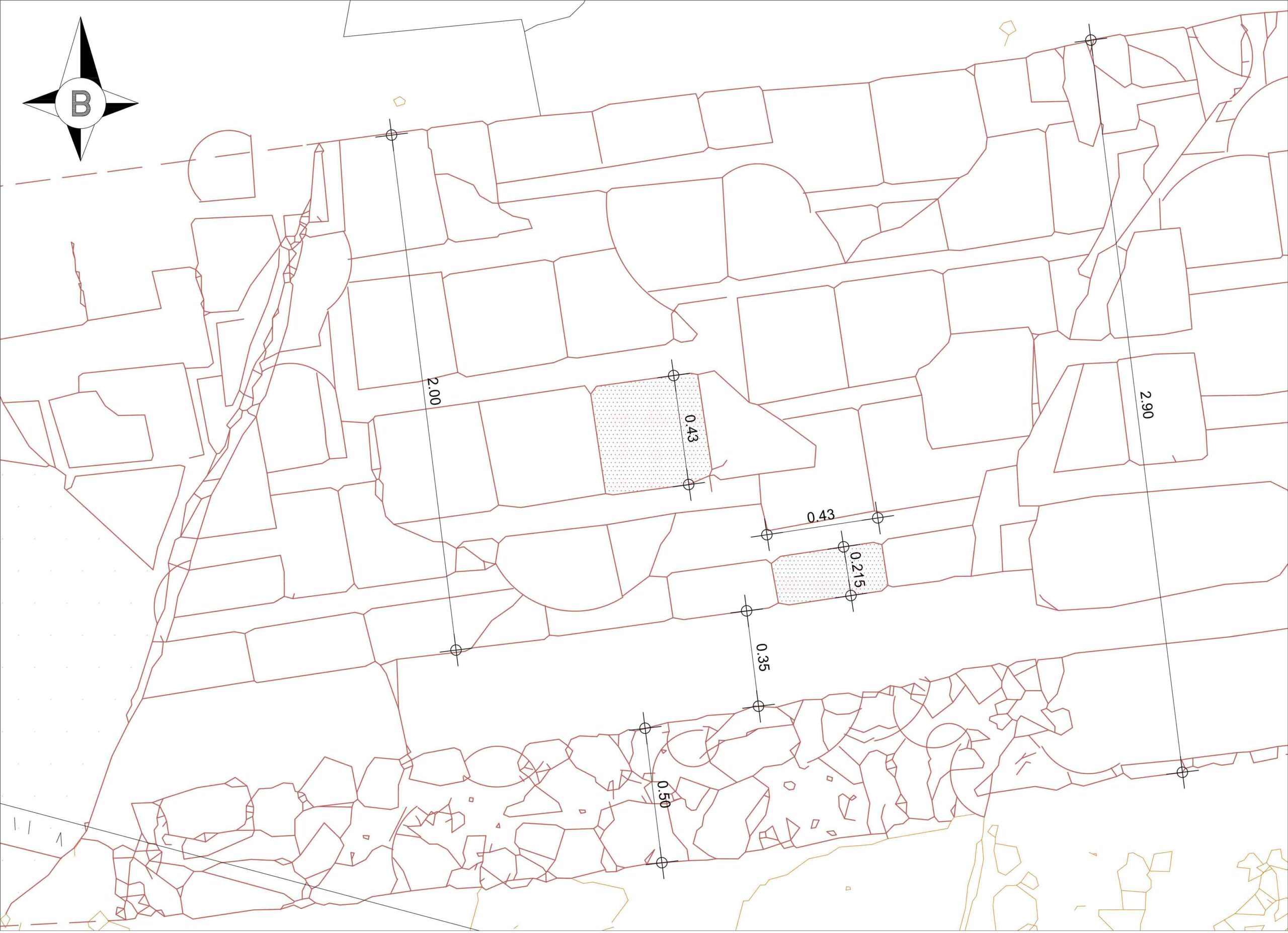
The brick body at the foundation is 2 m wide. The mud-bricks are square, 0.43 by 0.43 m, 0.07-0.08 m thick. Along the course of the wall, the bricks are adjoining, forming courses with joints ~0,08 m wide, filled with soil. In the superstructure, and for reasons of stability, stretcher half-bricks are laid in alternating rows, so that the joints bisect the mud-bricks of the overlying and the underlying courses up to the necessary height of defense.
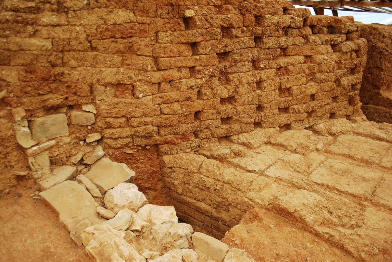
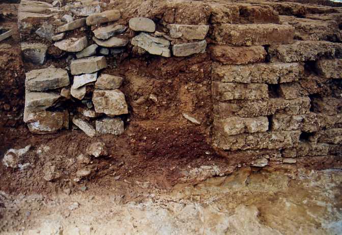
Site 1: The brick body is founded on the bedrock in a separate trench from the stone-built face that masks it internally. As the wall grows in height, brickwork overlies the stone fronting, and the width of the wall reaches 2.90 m. The differentiation in the colour of the mud-bricks and the soil used to fill the joints is due to the composition and processing of the raw material, respectively, while it contributed substantially to the distinction of the structure of the brick body.
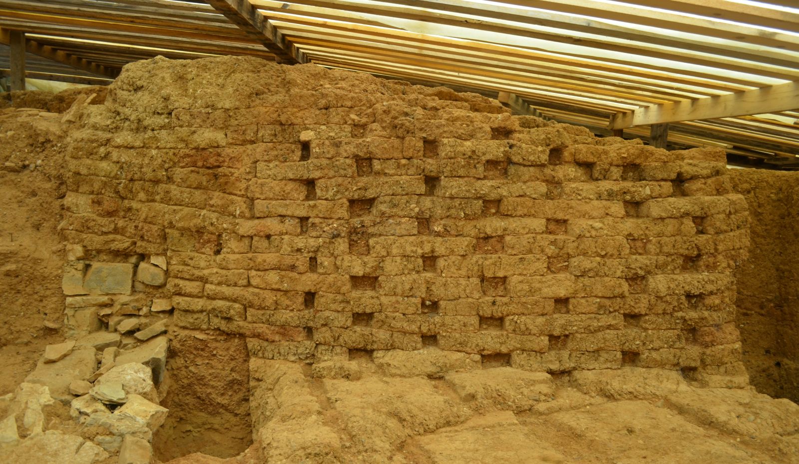
The stone face rests in a trench dug in a layer of barren pure clay, of particularly hard composition. Its foundation depth is about 0.40 m
higher than the resting level of the brickwork. The void between them, 0.35-0.43 m wide, was filled with soil, small stones and –in places- fragments of mud-bricks.
Regarding the axis of the course of the wall, the adjoining mud-bricks formed courses with joints approximately 0.08 m wide, filled with soil. More rarely, two half-bricks were used in the place of an intact mud-brick in the core of the wall.
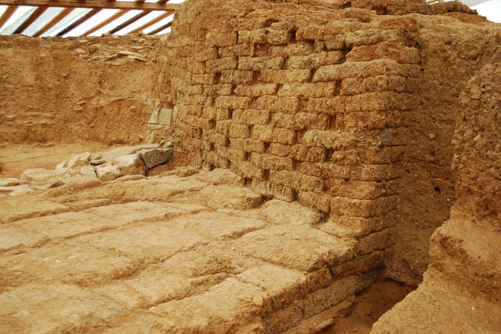
Part of the outer mudbrick face of the wall is visible.
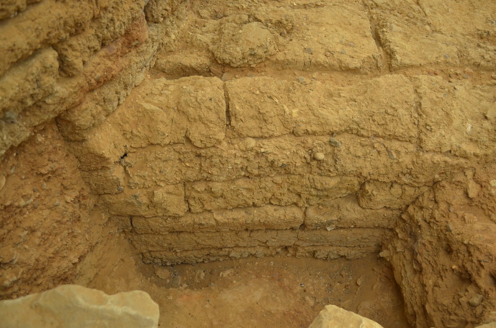
The brick body at the foundation is 0.35-0.43 m away from the stone face surrounding it internally.
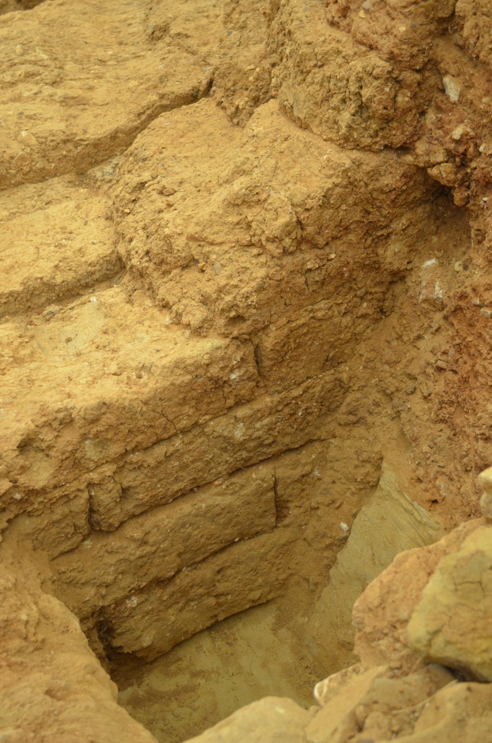
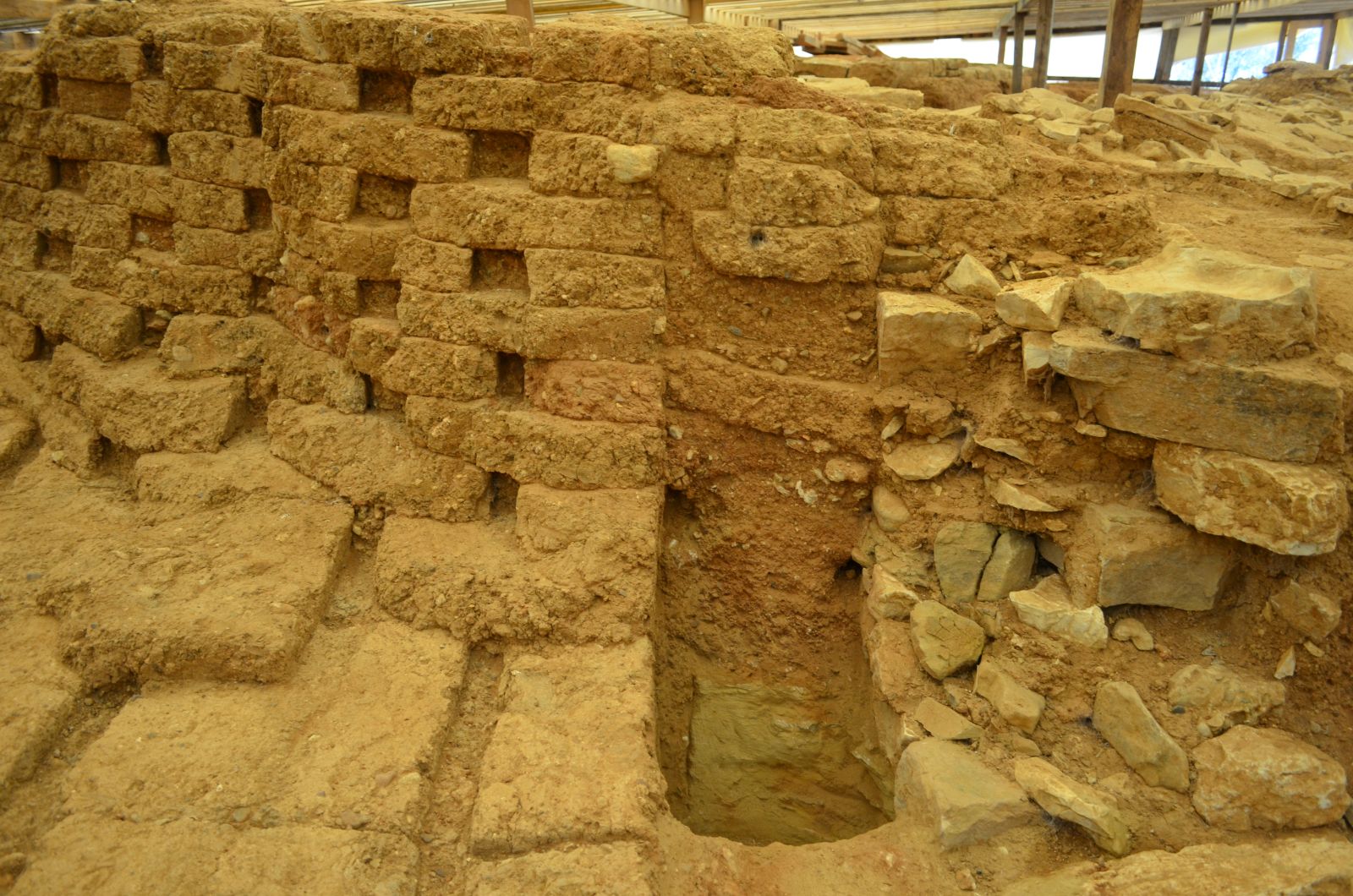
The gap between the brick core and the stone lining is filled with soil and mudbrick fragments. The separate foundation trench (bedding) for the brickwork is visible.
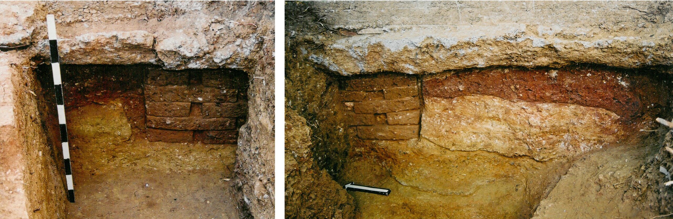
At the western preserved end, the wall is purely brick and is founded in a trench that was opened in the natural clayey fill.
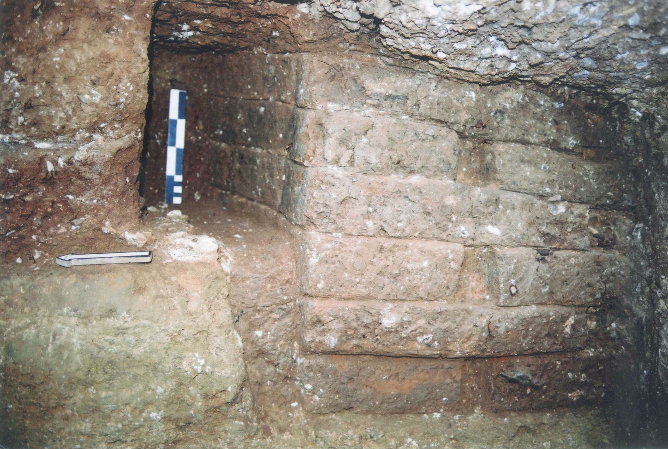
Notable on its exterior is the use of an uneven-sided mud-brick, which is used for special positions, such as curving points.
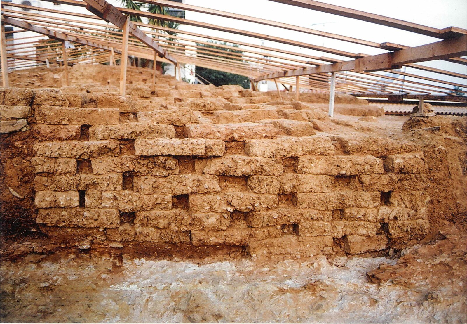
At the eastern preserved end, the brick body rests on the bedrock that has been appropriately dressed, while a small amount of clay has been used to level out the resting surface of the mud-bricks. The stone face rests also higher here.
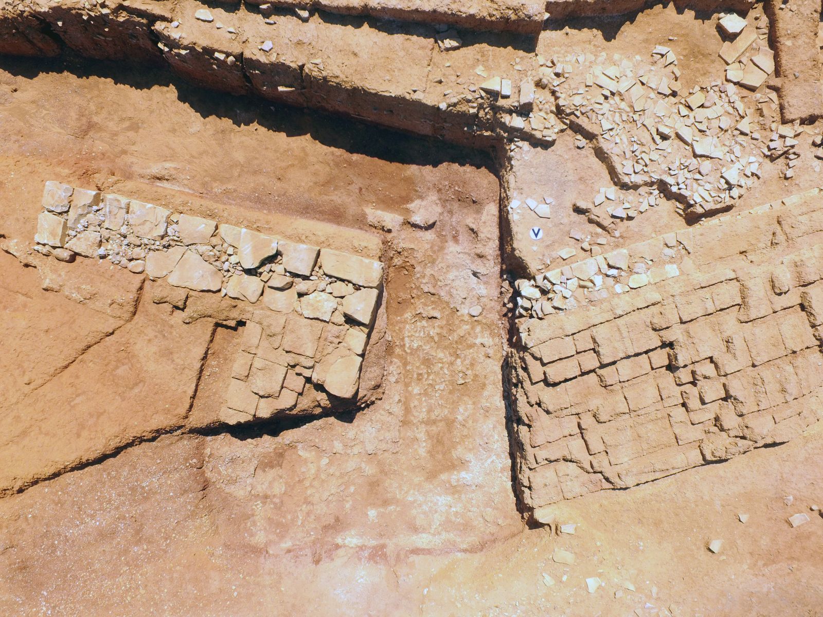
At site 1, the position of the east-destroyed part was occupied by a later section, redefining the defensive power. The stone faces, interweaved at a right angle, probably belong to a tower, as indicated by their strong construction at a curving point in the course of the wall. Inside, a small part of the brick core is preserved. This part is stronger than that of the adjacent wall, with which it shares common structural characteristics. It rests 0.50 m above the bedrock.
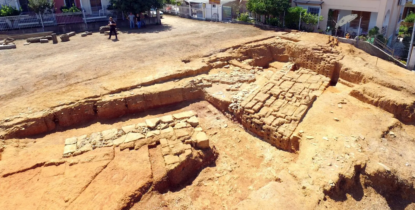
The sections of the wall on site 1 are representative of the walling system of this type, providing evidence for the ancient history and the cultural development of the region. Having the public benefit in mind but, above all, the protection, preservation and enhancement of this monument, the Hellenic Ministry of Culture has turned the extant remains into a proper archaeological site, open to visitors. The conservation study is prepared by the Directorate for the Conservation of Ancient and Modern
Monuments in collaboration with the Directorate for Research and Technical Support of Studies and Restoration Projects.
Gate
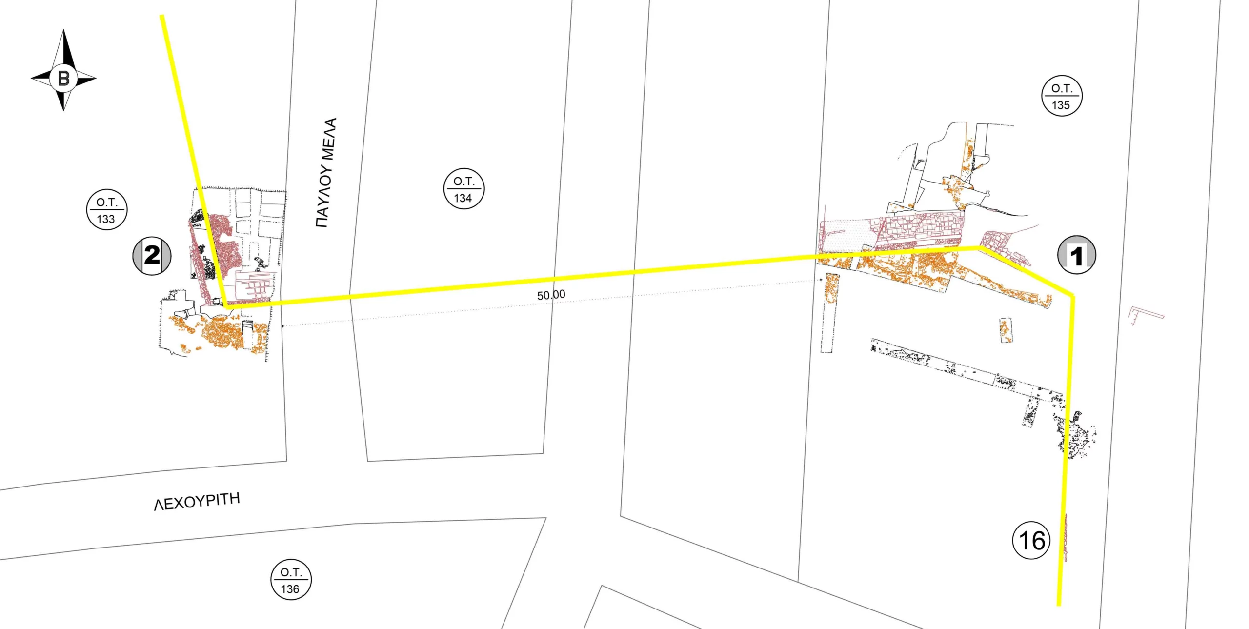
Part of a gate and a curving point of the wall were revealed at site 2.
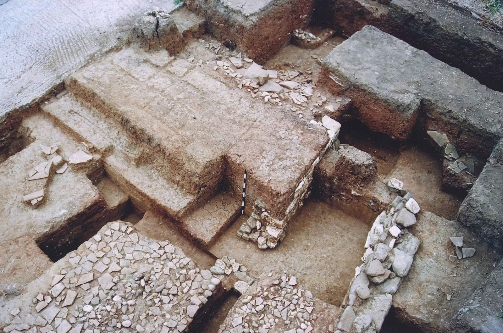
The wall at site 2 is interrupted normally. The mud-bricks, obviously deformed in the upper courses of the modern surface, cover the entire width of the wall, which reaches 2.90 m.
The brick body is lined at the base with a stone-built face in an obtuse angle, 1.10 m high and 0.50 m wide, resting on clean clay soil.
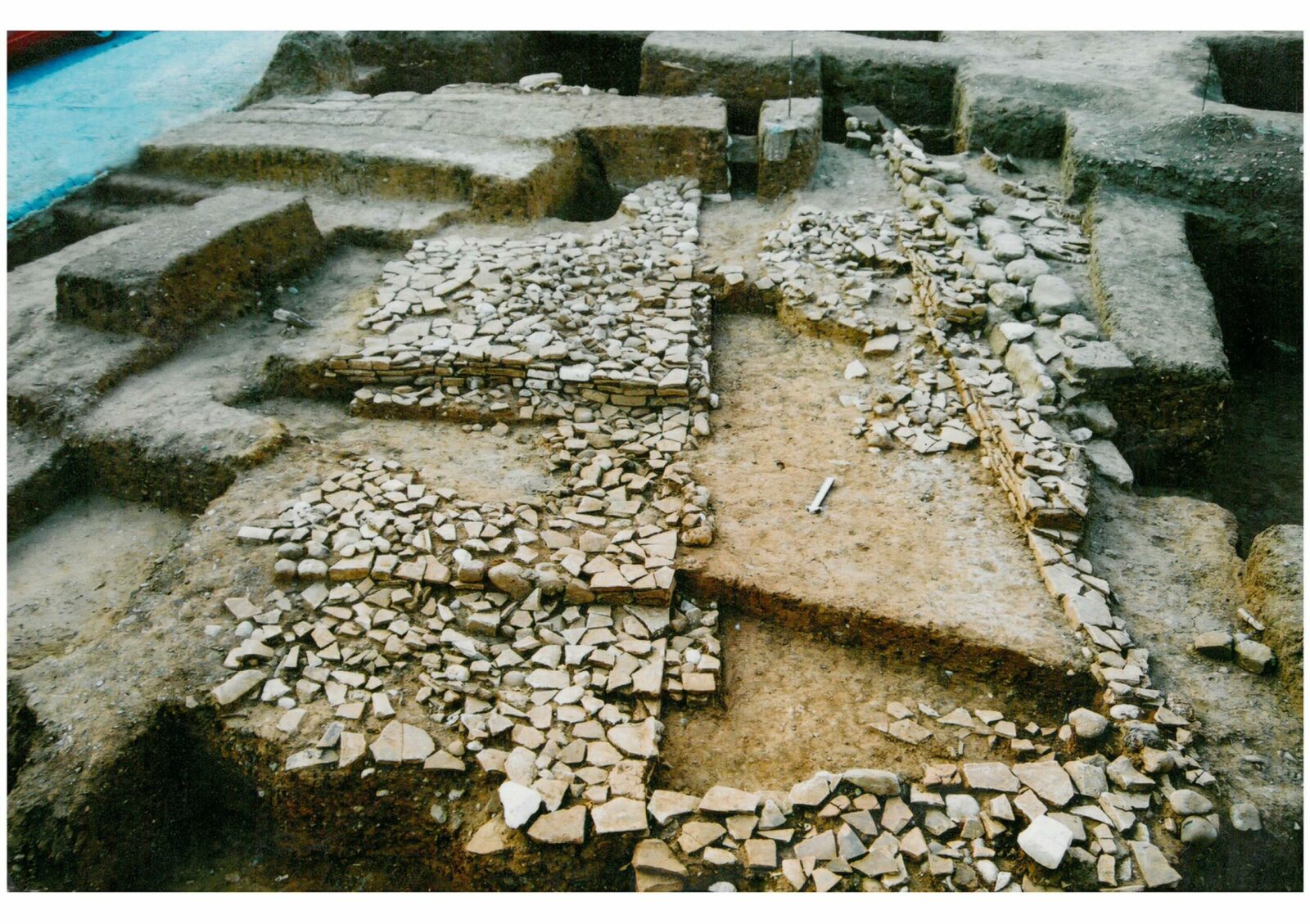
To the north, the gate is reinforced with a stepped structure following the natural slope, preserved 5.60 m in length and 2 m in width. It consists of three landings made of fragments of tiles and, between them, cobbles and rubble stones. The stepped structure is the resting bed of the mudbrick superstructure and frames a staircase. The steps, 1.40 m wide, are delimited by small built walls made of fragments of tiles.
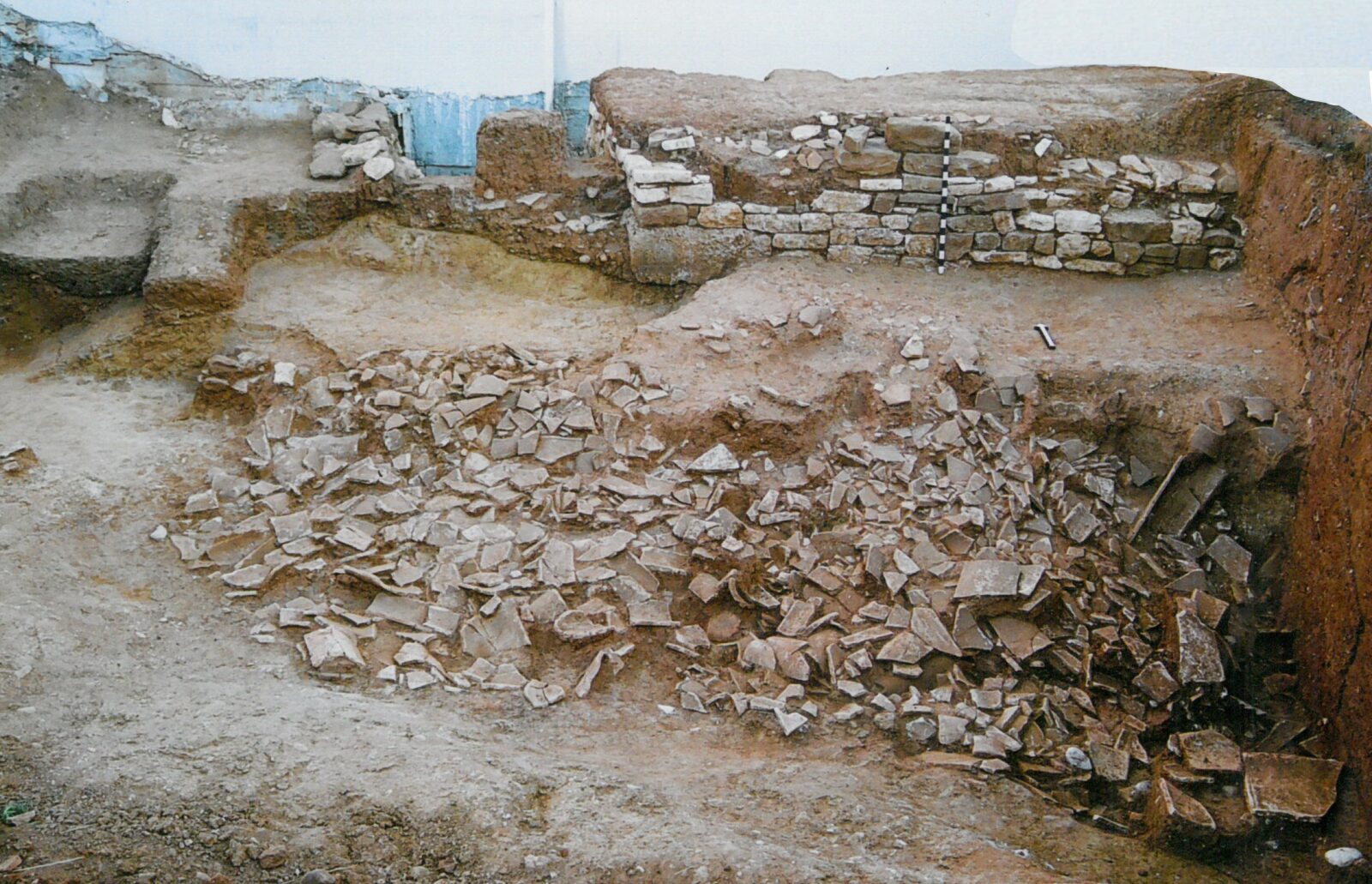
Inside the wall was revealed the destruction layer of the roof, consisting of Laconian-type tiles. The surface of many of them has a reddish, brown or reddish-brown coating (mainly on the concave and sometimes on the convex side), as a means of protection from weathering conditions.
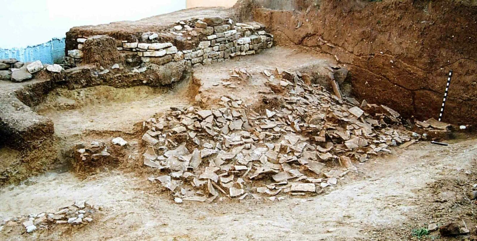
Inside the wall, where the ground is uphill, an artificial drainage channel for the rainwater outflow, of maximum width of 3 m and approximately 1 m deep was found at a short distance from it, opened in the natural ground. Its presence and dimensions are suggested by the destruction layer of its roof that has collapsed inside it.
Stone face of the wall
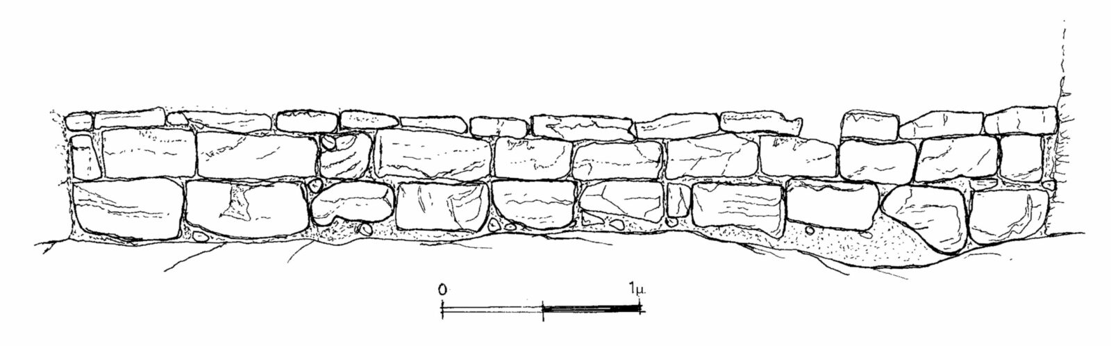
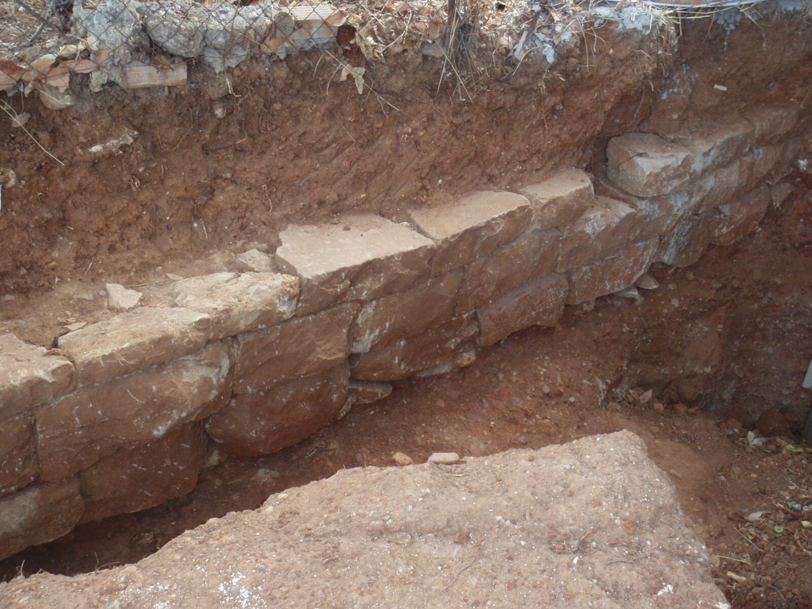
At site 5 of the wall, a stone interior face (0.50 m wide and 0.65 m high) was revealed, following the irregular trapezoidal masonry mode. Small stones and tiles were placed underneath the blocks (made of sandstone) for the sake of more effective leveling.
An internal ring road
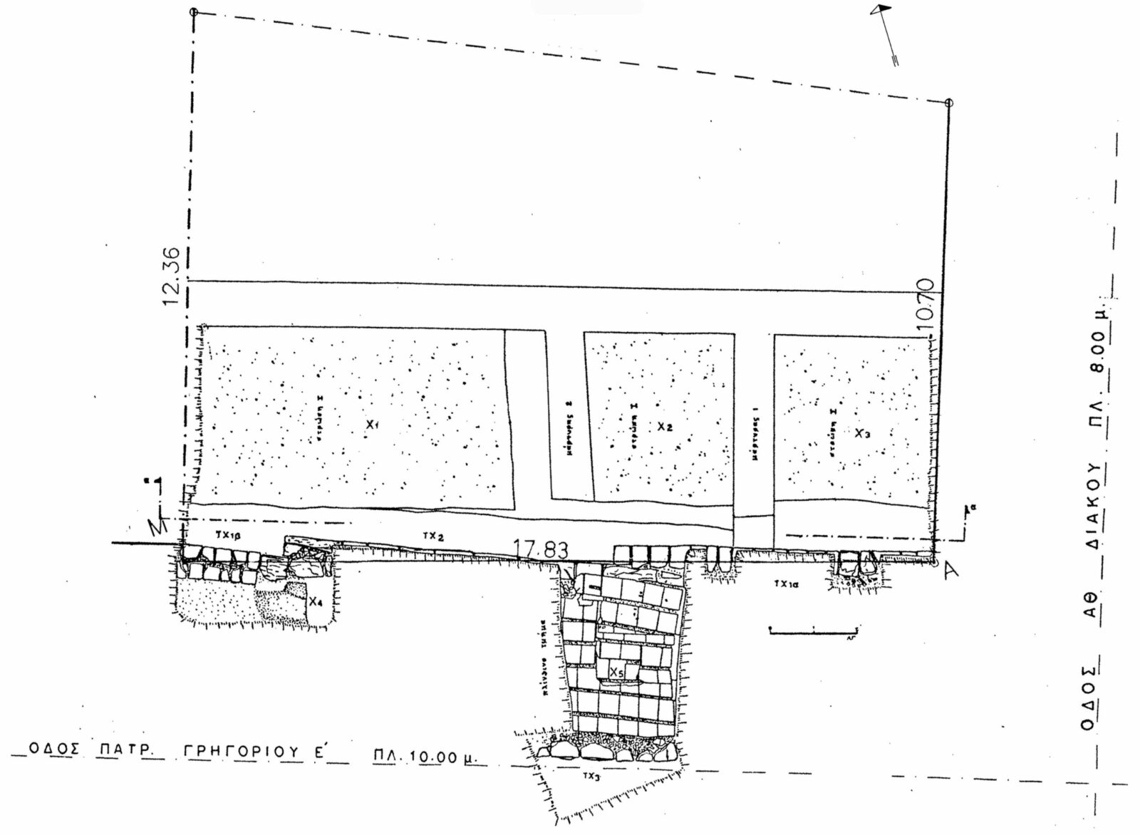
The city was easily accessible from the south, without natural fortification. This led the Dymaeans to reinforce the vulnerable southern branch of the wall. Its section, which was revealed at site 10, was found at the end of a trial trench dug transversely to the course of the modern road at the boundary of the modern settlement.
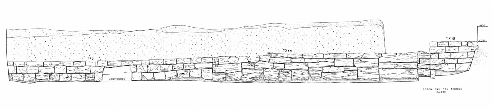
The inner stone face of the wall is preserved intact and was constructed in two phases.
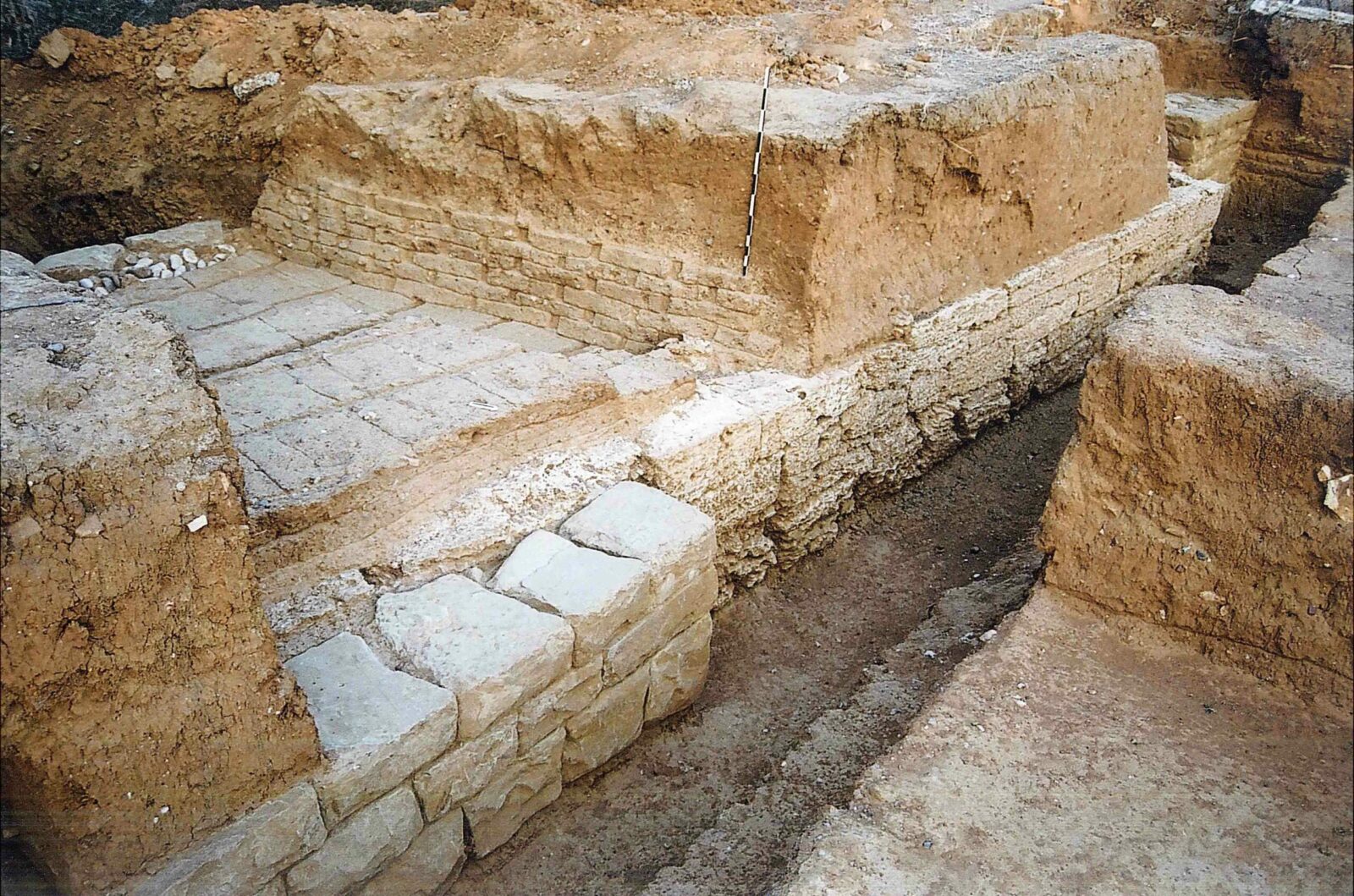
The difference in the structural materials of the stone wall face and the slight deviation of the two stone faces in relation to the longitudinal axis confirm the two construction phases.
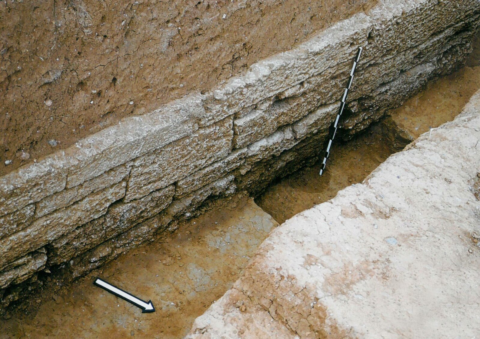
The limestone face of the first phase has a height of 1 m and visible length of 8.40 m. It consists of rectangular and unevenly sized stone blocks, 0.50 to 1.50 m long and 0.10 to 0.50 m high. The choice of the building material and the mode of construction aim at the stability of the structure. One to two low courses of large-sized blocks form the foundation and are roughly dressed. The two to three upper courses belong to the superstructure.
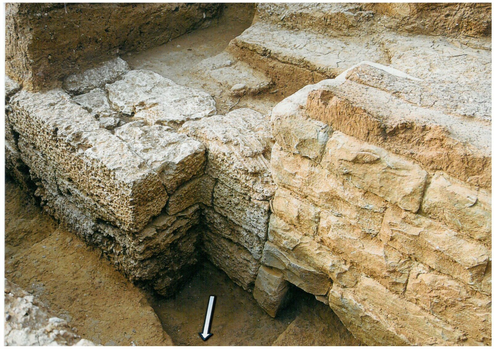
The limestone face at the western end creates indentations and is interrupted. At the indentation point, the maximum width of the wall is 1 m.
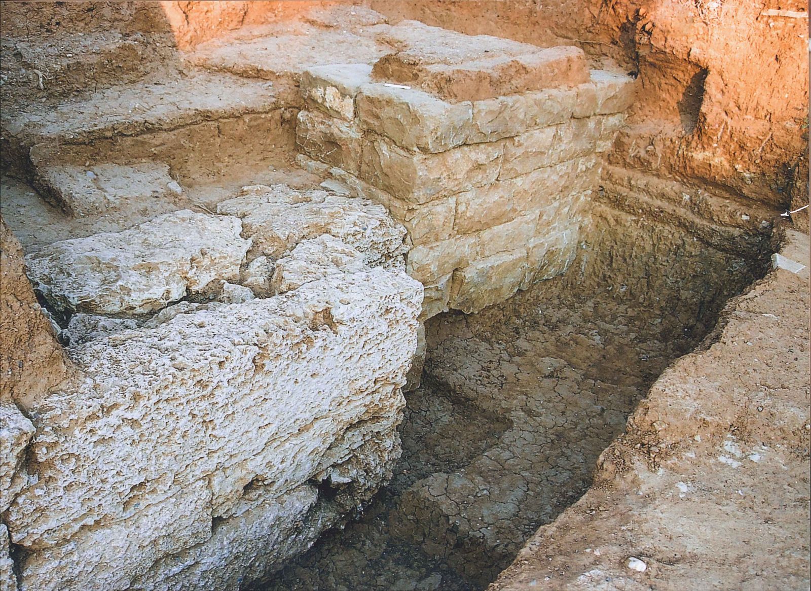
In contact with the limestone face, a built front with rectangular sandstones was revealed, following the isodomic masonry mode, of visible length 1.90 m, height 1.15 m and width 0.65 m. Traces of a white coating that served as a protection layer for the perishable construction material and contributed to the aesthetic uniformity of the work are discernible. The differentiation in the masonry and materials observed in the first building phase of the wall could be attributed either to different contracts or to different construction periods of the project. The levelling course of the sandstone section protrudes beyond the overlying ones (superstructure) and rests, like the road surface, on the natural clayey ground.
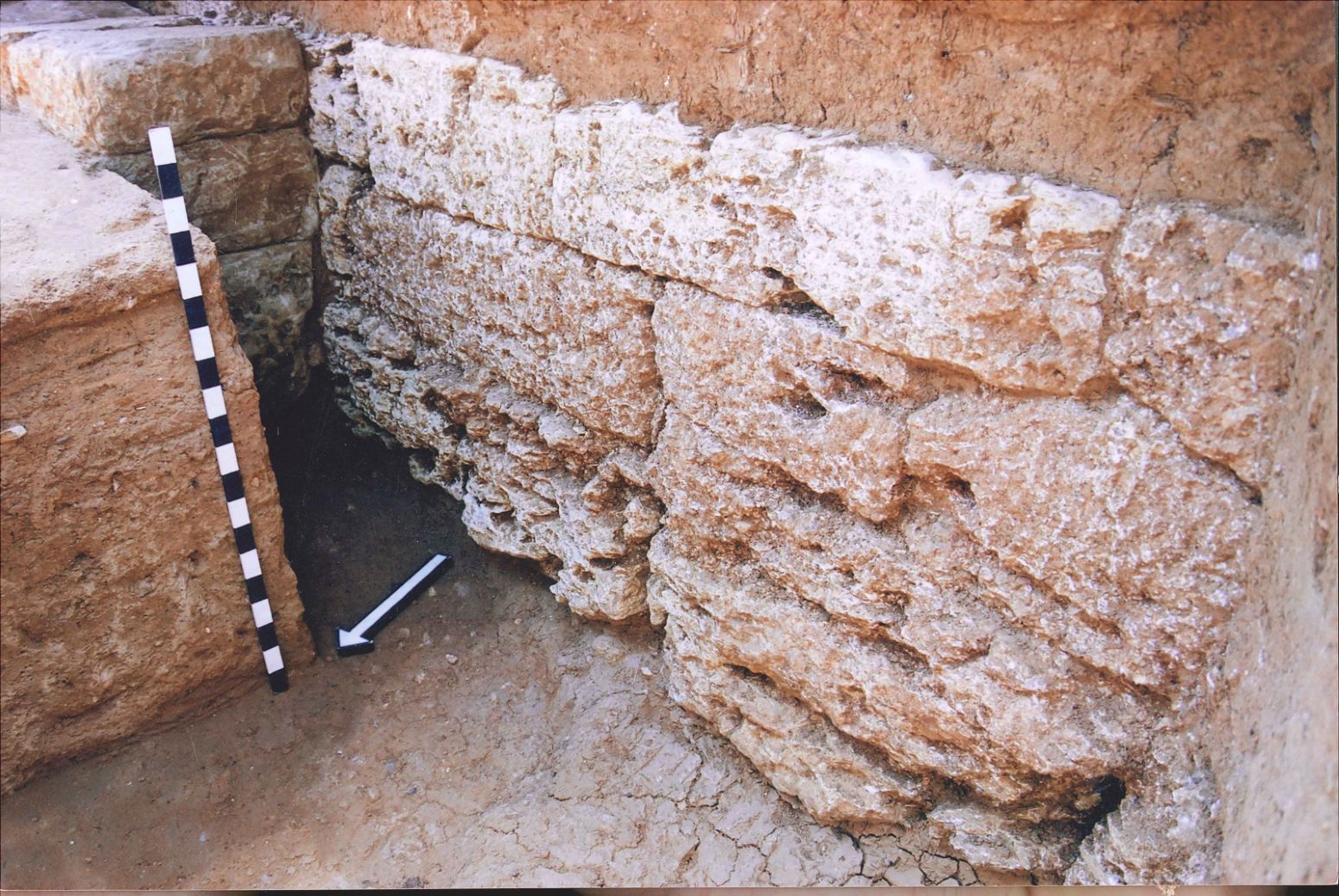
In the second construction phase, a stone face made of sandstone blocks (0.80 m high and 0.60 m wide, approximately, in total) lines the limestone part of the first phase. The western visible end of the courses of the second phase is adjacent to the face of the first phase.
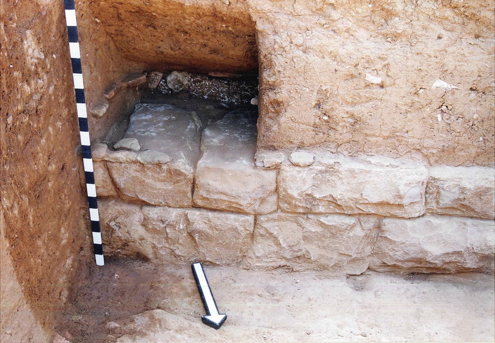
The excavation of small trenches along the inner side of the wall showed that the inner limestone face of the first phase extends even further east behind the face of the second phase, with its total visible length reaching 14.60 m. There is a slight deviation in the directions of the two stone fronts.
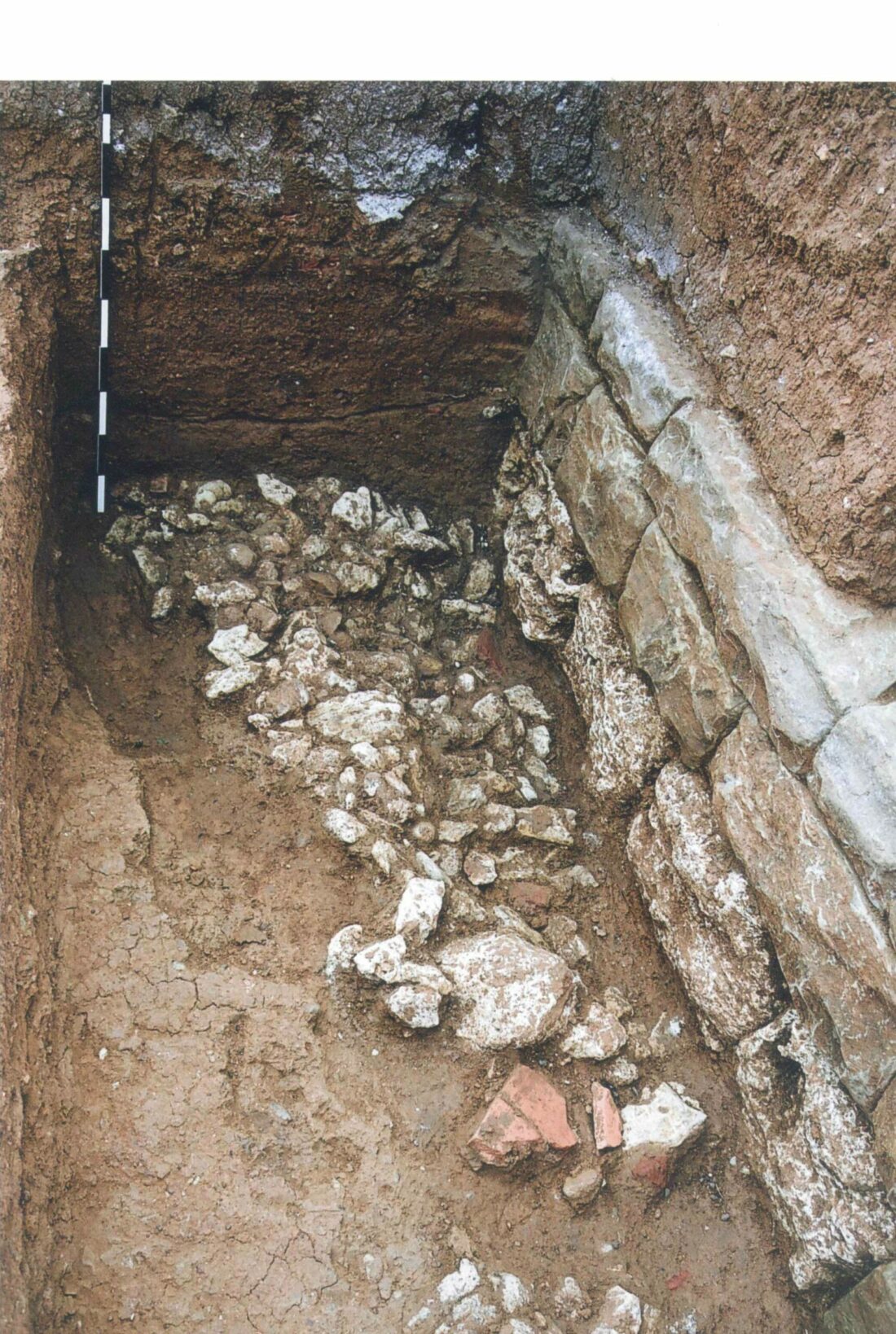
The foundation shows the reuse of limestone blocks from the first construction phase. At foundation level, a breccia layer indicates the on-site dressing of the blocks.
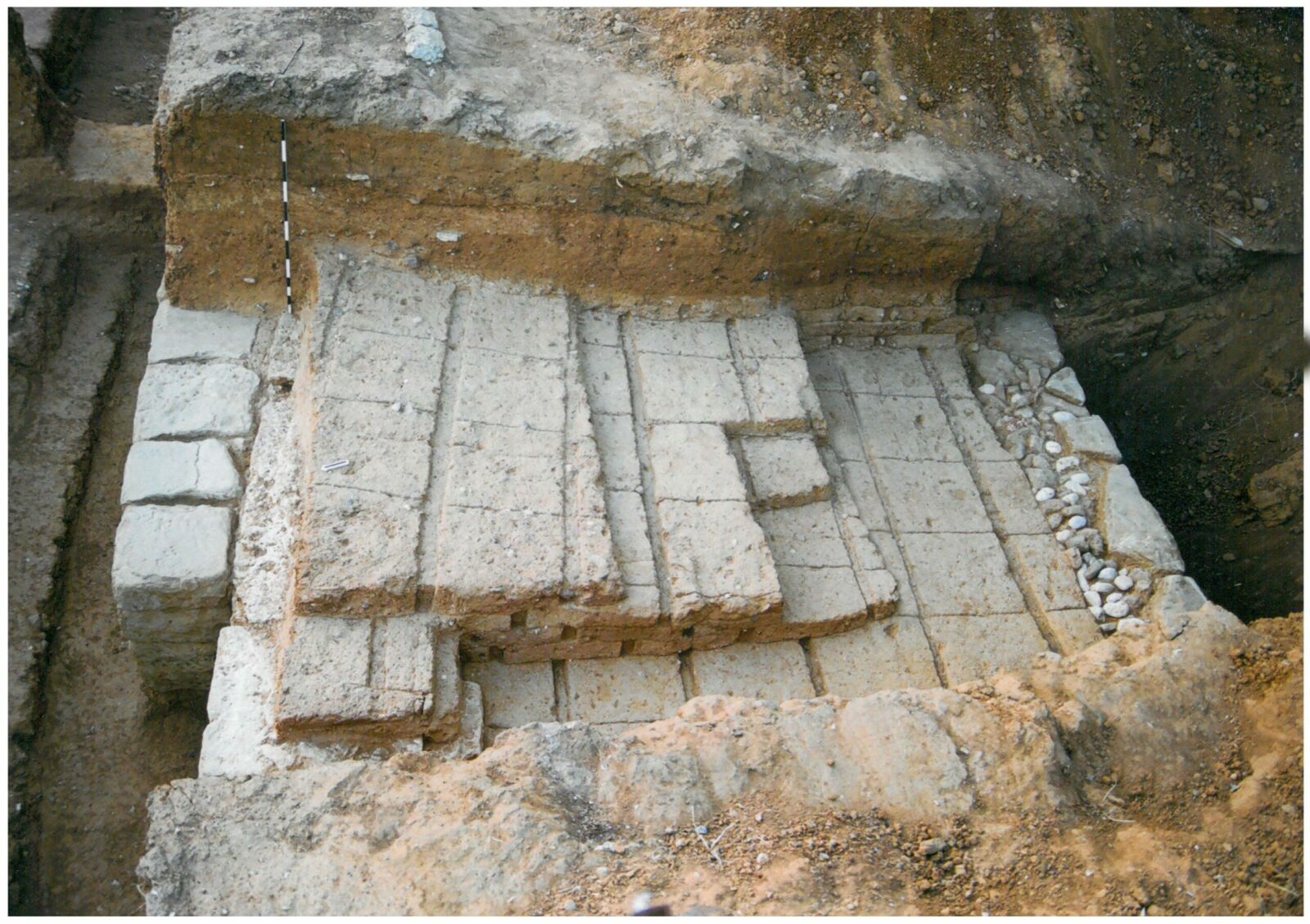
The main body of the wall is solid and consists of square mud-bricks of 0.47 m, 0.09 m thick, approximately. The faces of the wall of the first construction phase were reinforced with sandstone blocks in the second phase.
The width of the wall of the first construction phase reaches to 3.90 m, and with the fortification additions it reaches 5 m.
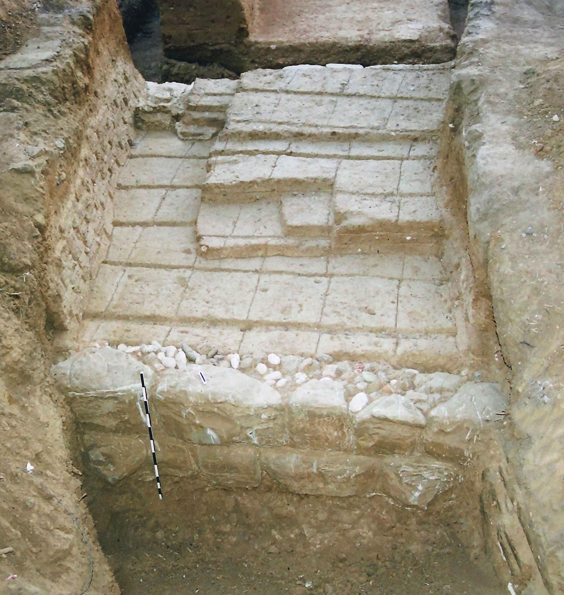
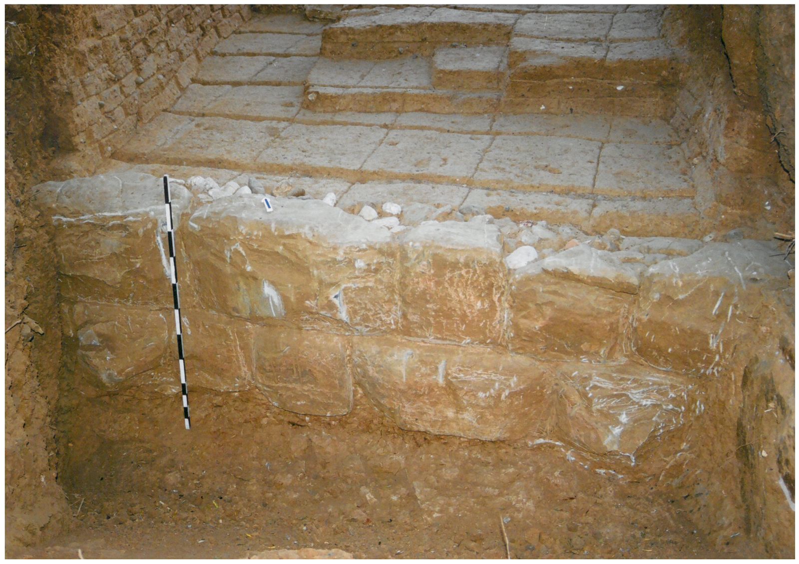
The stone outer face, revealed 3.40 m long and made of two sandstone courses, it was located only at the boundaries of the trial trench that was dug transversely to the width of the modern road. The outer surface is roughly dressed with groove-like carvings.
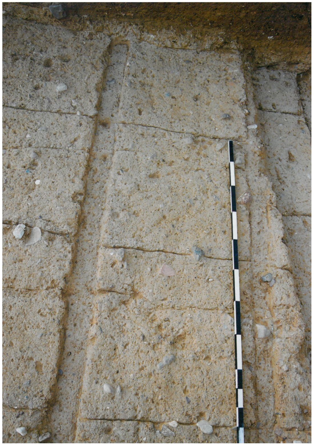
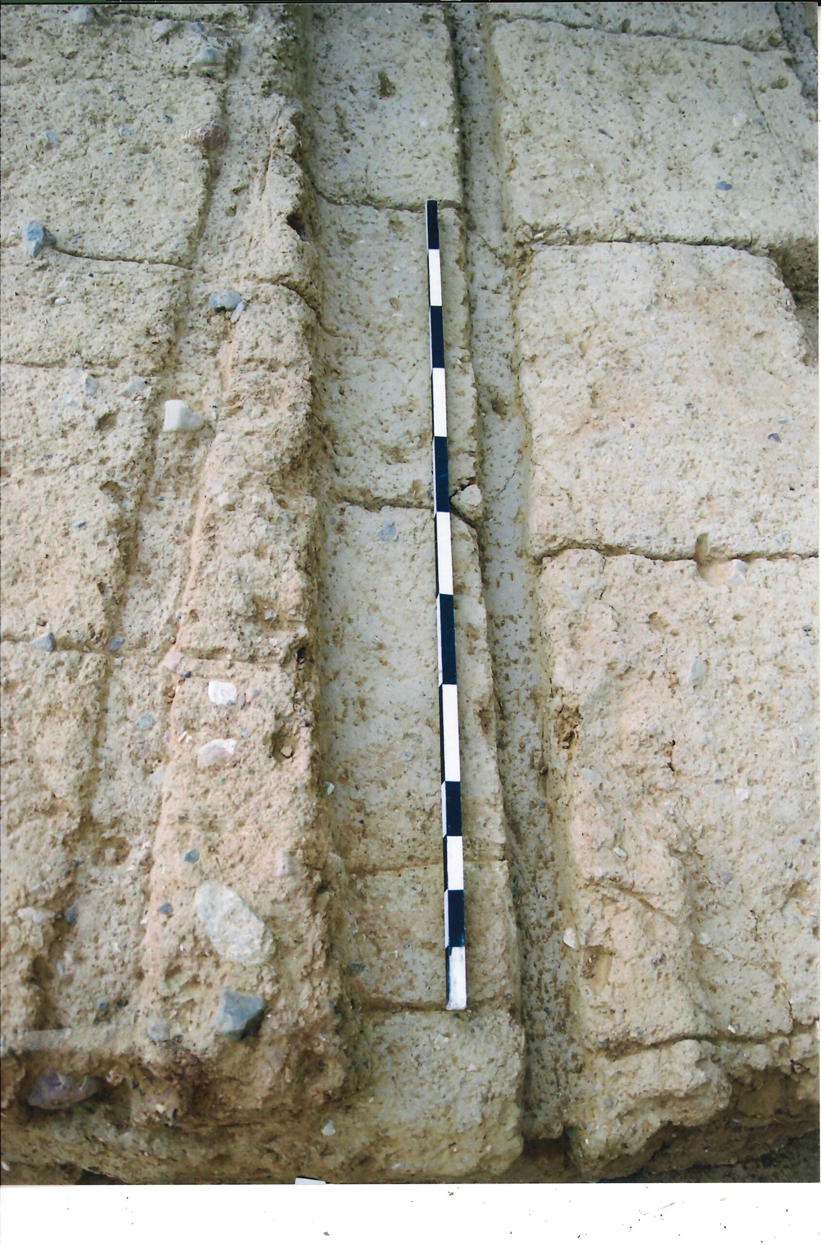
The adjoining mud-bricks in the course of the wall create courses, separated by a 0.05 m wide joint, filled with soil.
Between the brick body and the stone lining of the outer face of the wall there is a void (filled with small pebbles and rubble stones) probably to counteract the effect of humidity.
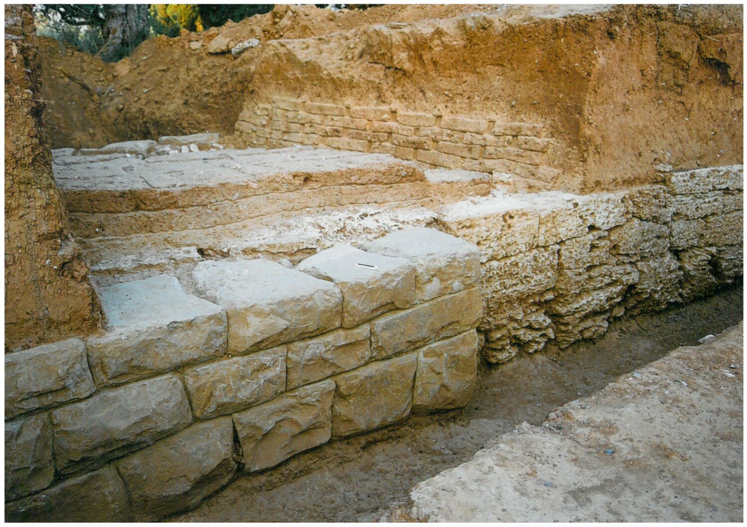
Mud-bricks are laid in successive courses using semi-bricks at the ends for reasons of stability, so that, at wall face, the joints bisect the mud-bricks of the overlying and underlying courses. The upper courses of mud-bricks appear deformed due to erosion.
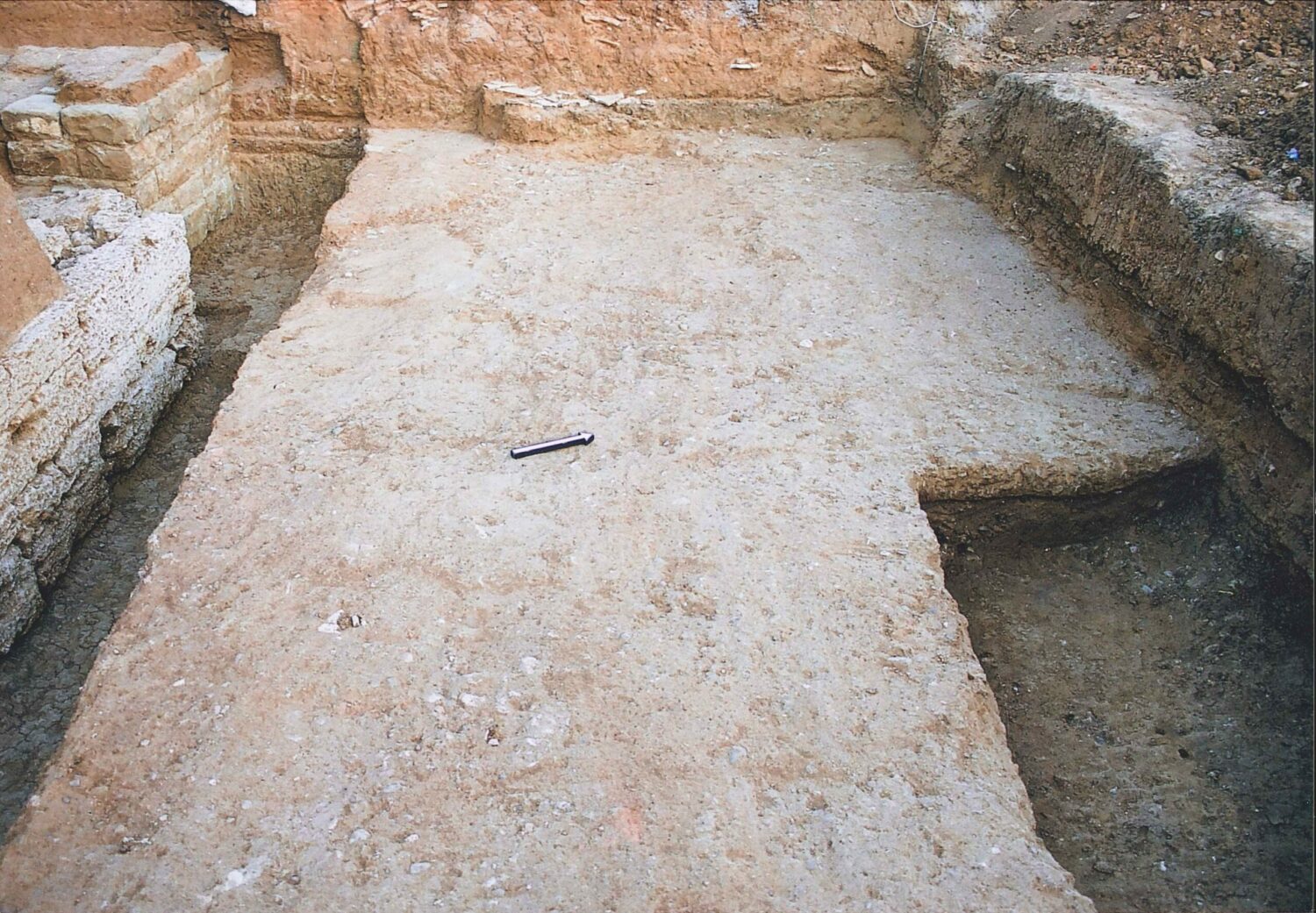
Inside the wall and in contact with it, at the superstructure-foundation borderline, a 0.15 m thick road was revealed, made of rammed earth and gravel.
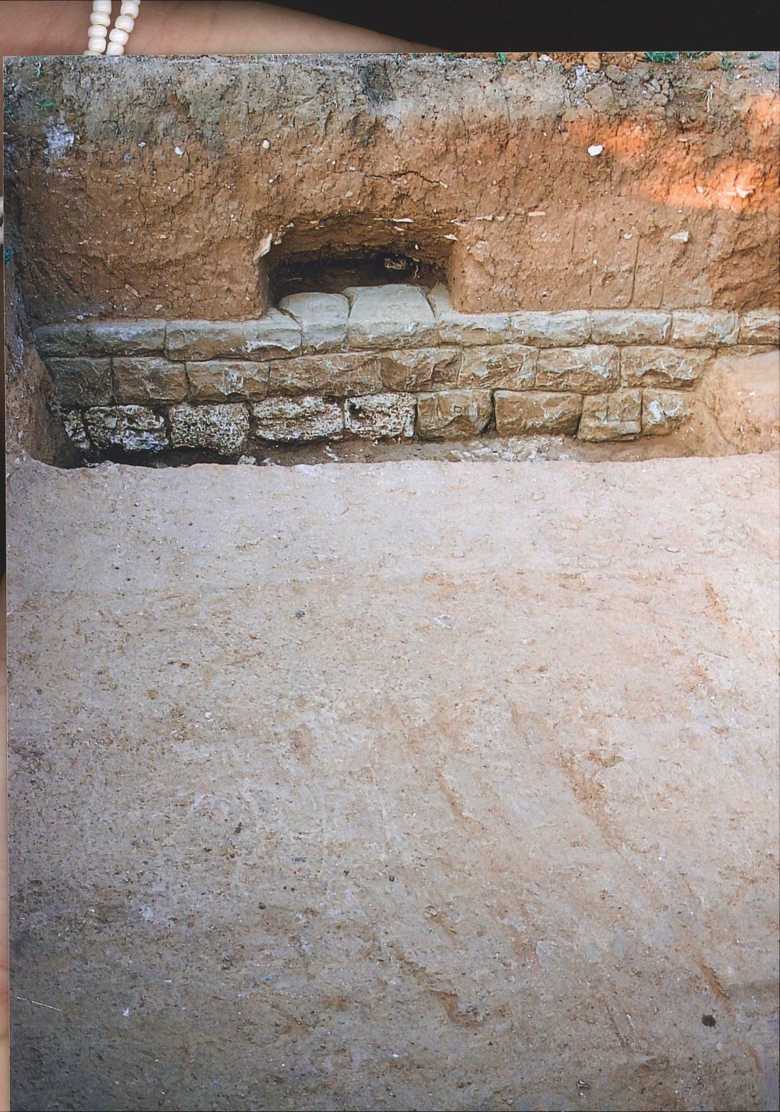
It is an internal ring road 5 m wide, which facilitated traffic in the city (through the gates) but also the maintenance works on the wall.
Bulwark
The only part of the fortification to date that belongs to the type “of the two stone sides” is located at site 11b with internal filling, 2.50 m wide. It consists of two parallel built fronts with pseudo-ashlar masonry made of rectangular, roughly dressed, sandstone blocks that contain the internal filling of soil, rubble and semi-dressed stones and fragments of roof tiles according to the emplekton masonry. The stone face is preserved at a height of two courses and fragmentary due to stone looting. The preserved bonding stones penetrate towards the inner part of the front and interlace with the filling to enhance the defensive capacity.
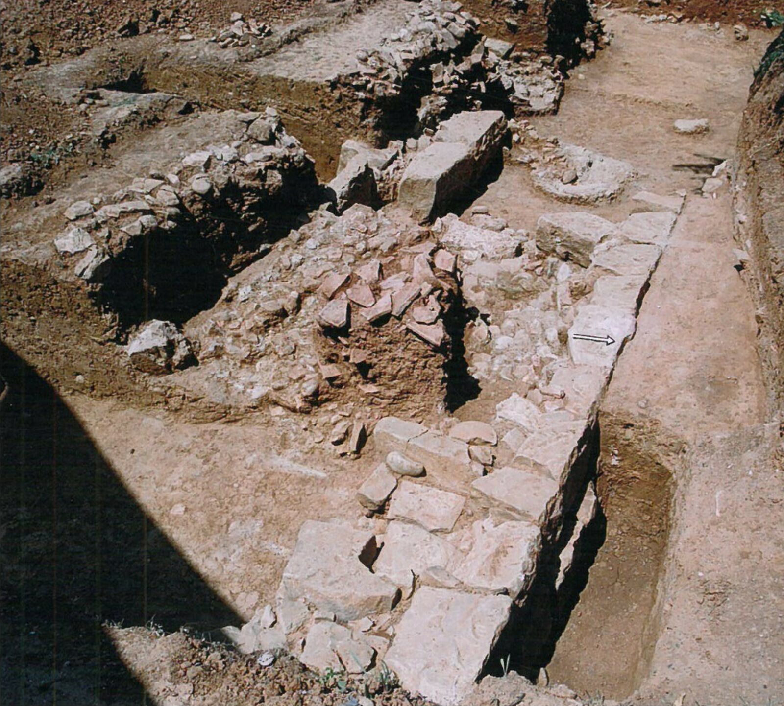
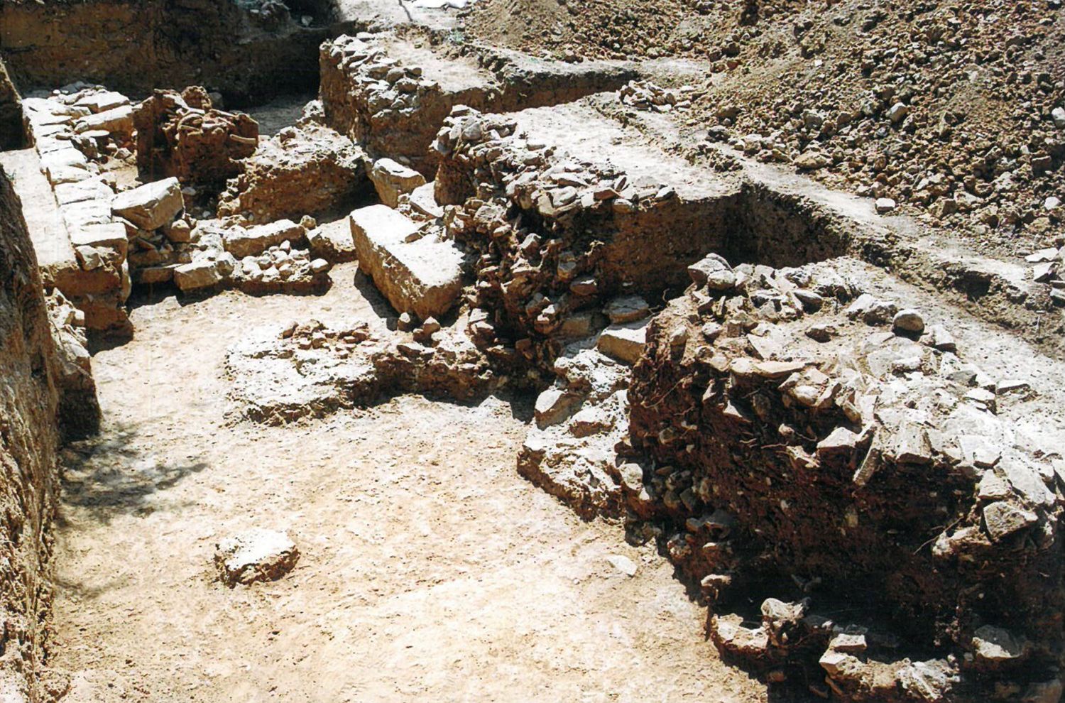
The remains are likely to belong to a part of a bulwark that served as a strong wall to reinforce the defense of the southern branch of the wall and to prevent the access of the enemies’ siege towers and battering rams.
Tower
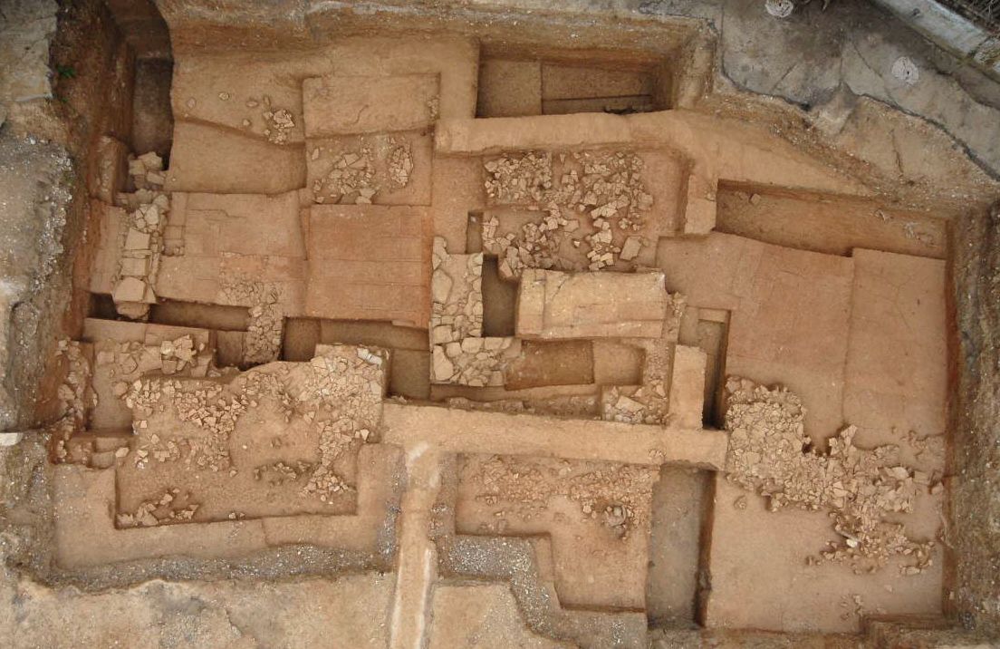
At site 15, parts of the wall on either side of the tower were revealed. Internally, the destruction layer of its roof also indicates its course. The tower protected the curving point.
The ground plan of the excavation shows the course of the wall. The width of the tower (according to the sandstone remains, discovered in a trench along the east outer side of the structure) reaches 6.70 m, while its preserved length is 5.70 m (N-S). The revealed dimensions indicate a square-plan tower.
South of the tower was found only the foundation trench of the wall formed in the yellowish clayey ground, with clearly corroded structural materials. However, the color differentiation of the fill allowed the tracing of the course of the wall, which bends westwards following the natural terrain.
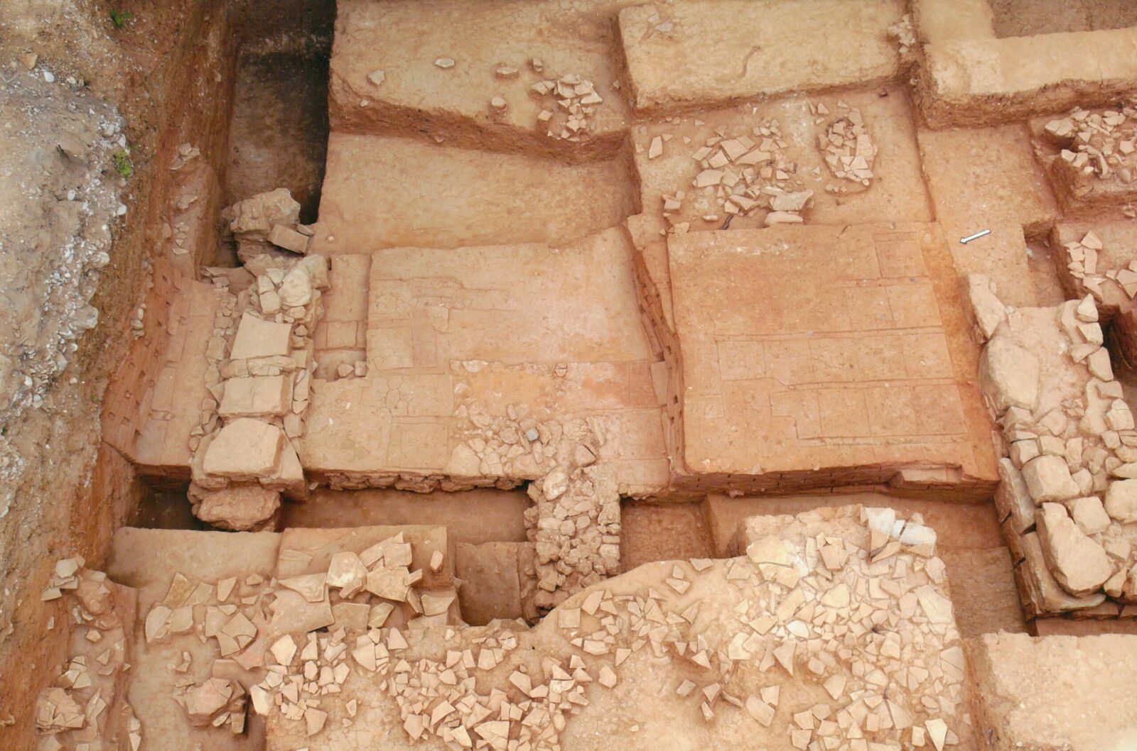
Of interest is the existence of two purely brick sections of the wall, and between them a built rainwater channel and a buttress. They are connected by means of a construction joint. This design allows for the autonomous operation, adaptation and harmonious integration of the individual sections of the wall into the natural terrain.
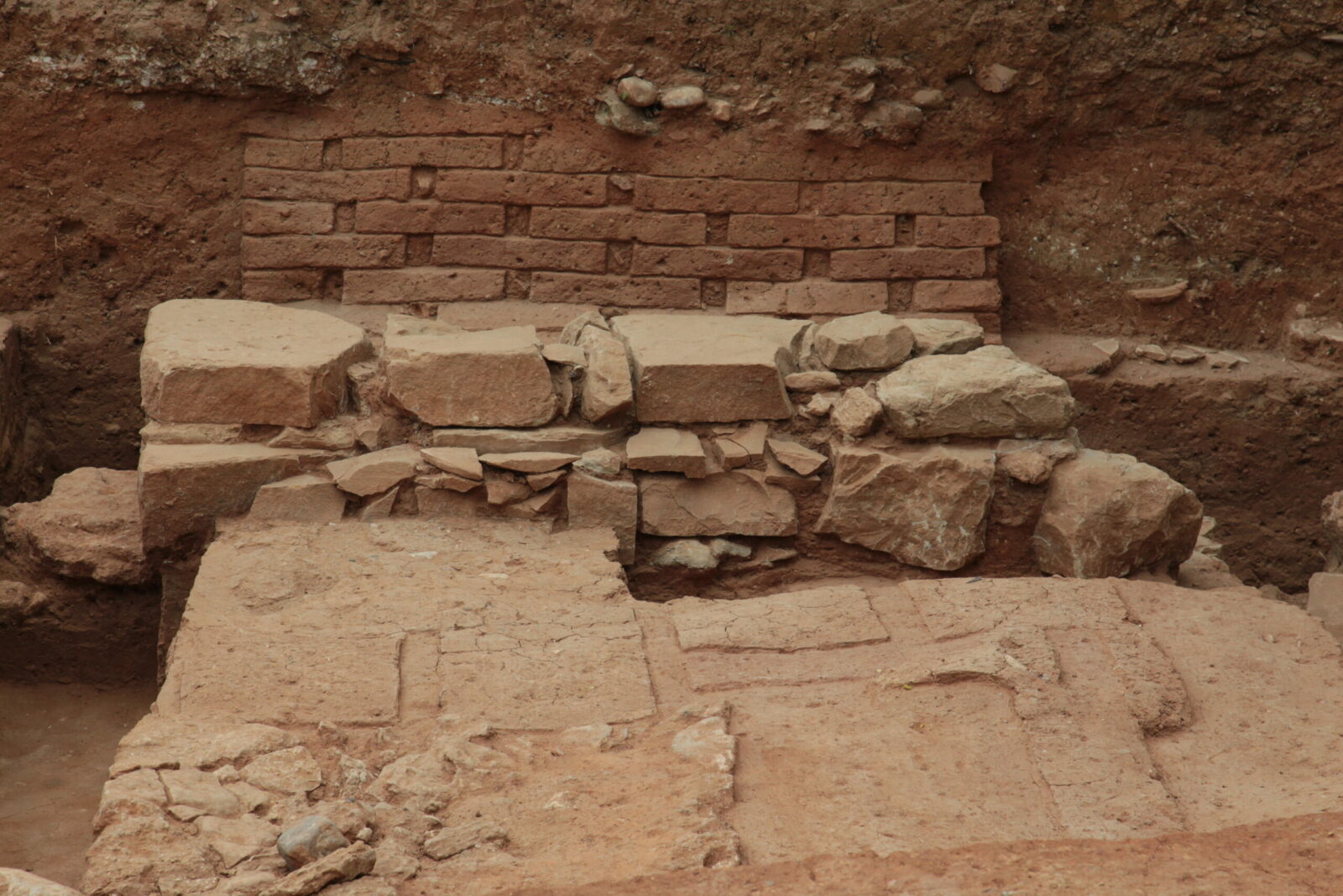
A brick body (of 2.22 m preserved width) penetrates the north side of the trench. Eight to nine successive courses of mud-bricks were found.
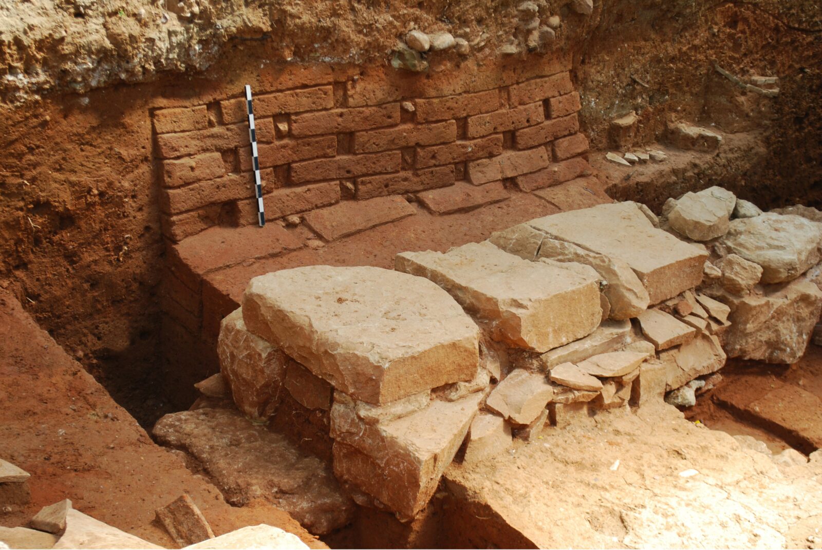
Between the pure brick body and the rainwater channel, there is a construction joint (~0,20 m wide) that is filled with soil. The channel, transverse to the course of the wall and inclined towards the eastern face, conducted the water runoff outside and beyond the fortification.
The channel rests 0.40 m lower than the brick body and protrudes from the inner face of the wall by 0.45 m.
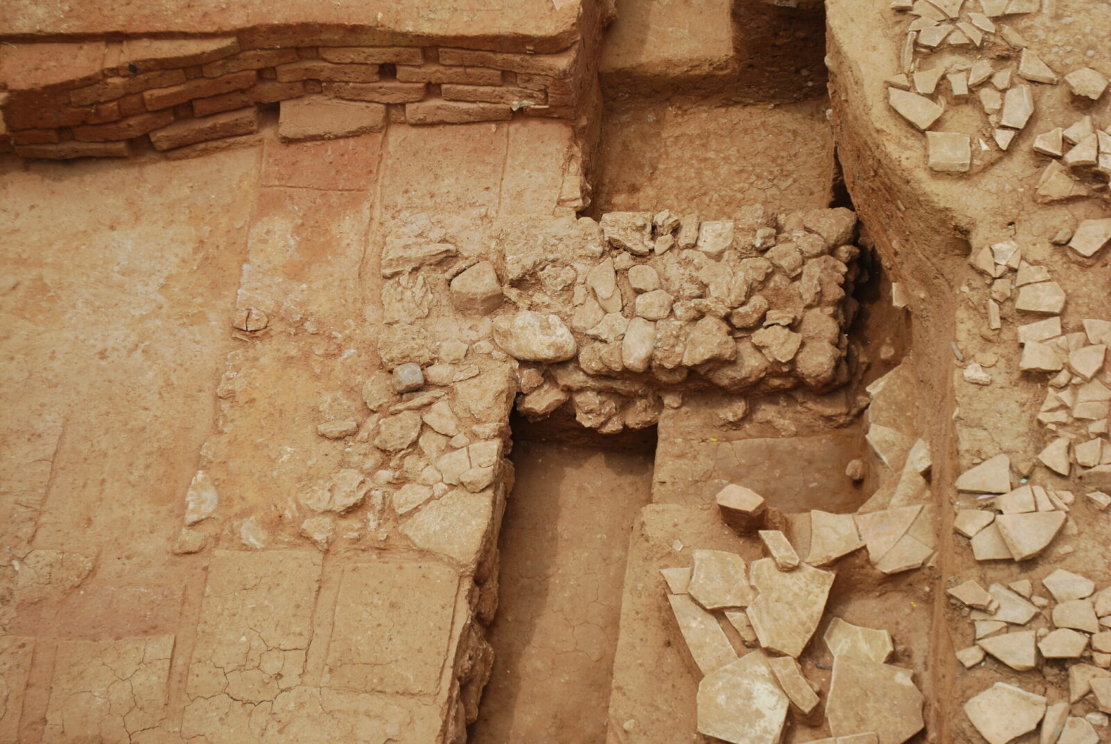
South of the channel, the brickwork is reinforced internally with a built L-shaped buttress. Part of the buttress penetrates under the brick body and protrudes from the inner face of the wall by 1 m. In the part embedded in the brick body, clay is preserved on the surface of the stones, which created a flat surface for the placement of mud-bricks in height.
The buttresses, in addition to elements of wall reinforcement, are also interpreted as pillars to support arches for the widening of the parodos.
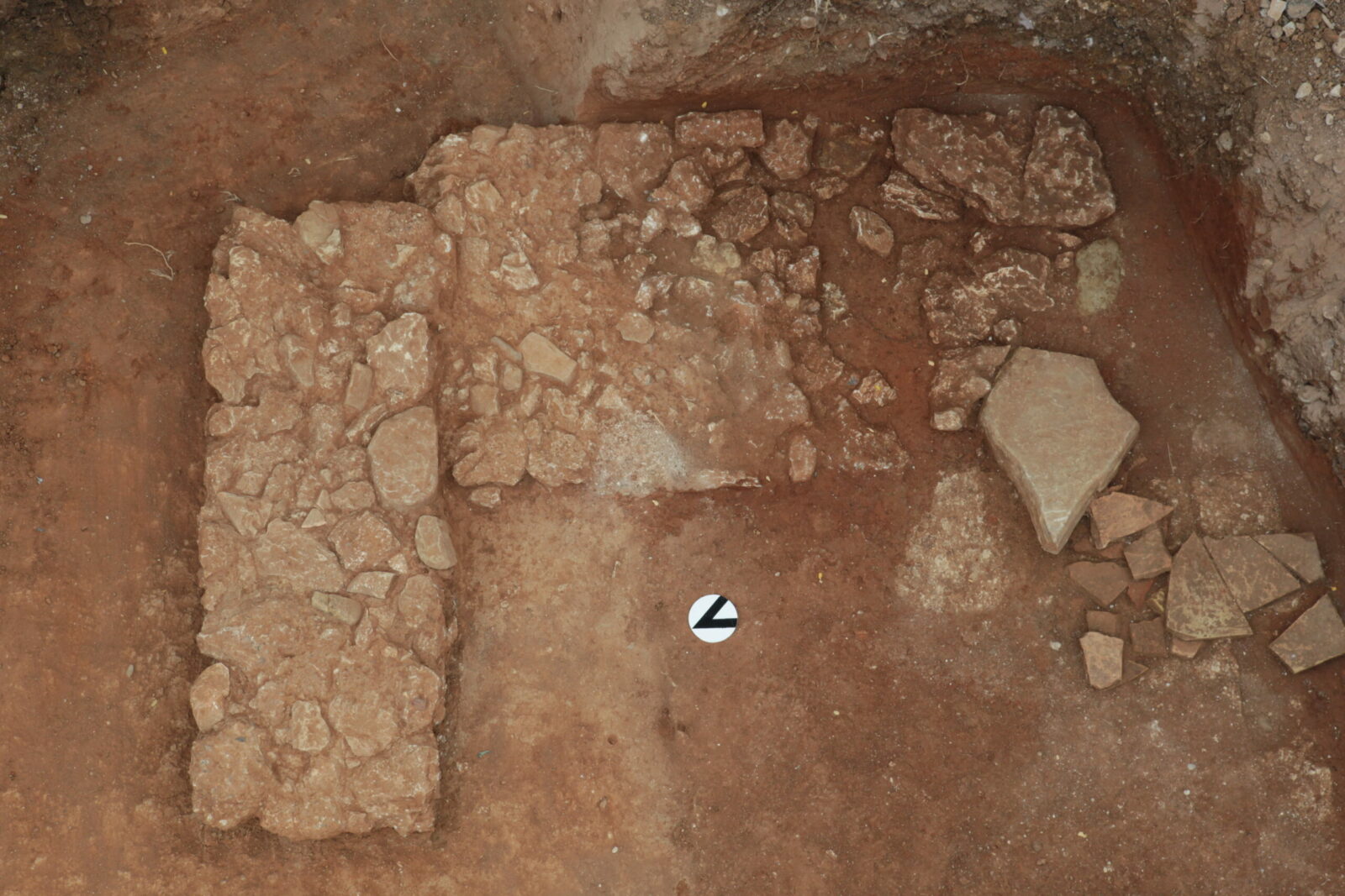
In the course of the wall, 35.50 m further north, at the boundaries of a trial trench, a stone section of similar structure and form to the buttress was revealed. Additionally, remains of brickwork and a destruction layer of Laconian-type tiles from the roof of the wall were found.
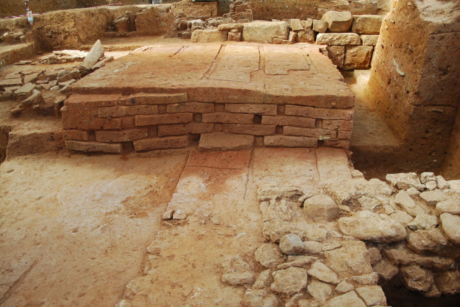
A purely brick body, 2.90 m long, follows south of the buttress, preserved at a width of 2.30 m. It rests on a layer of barren clay of hard texture, while it preserves up to six successive courses of mud-bricks.
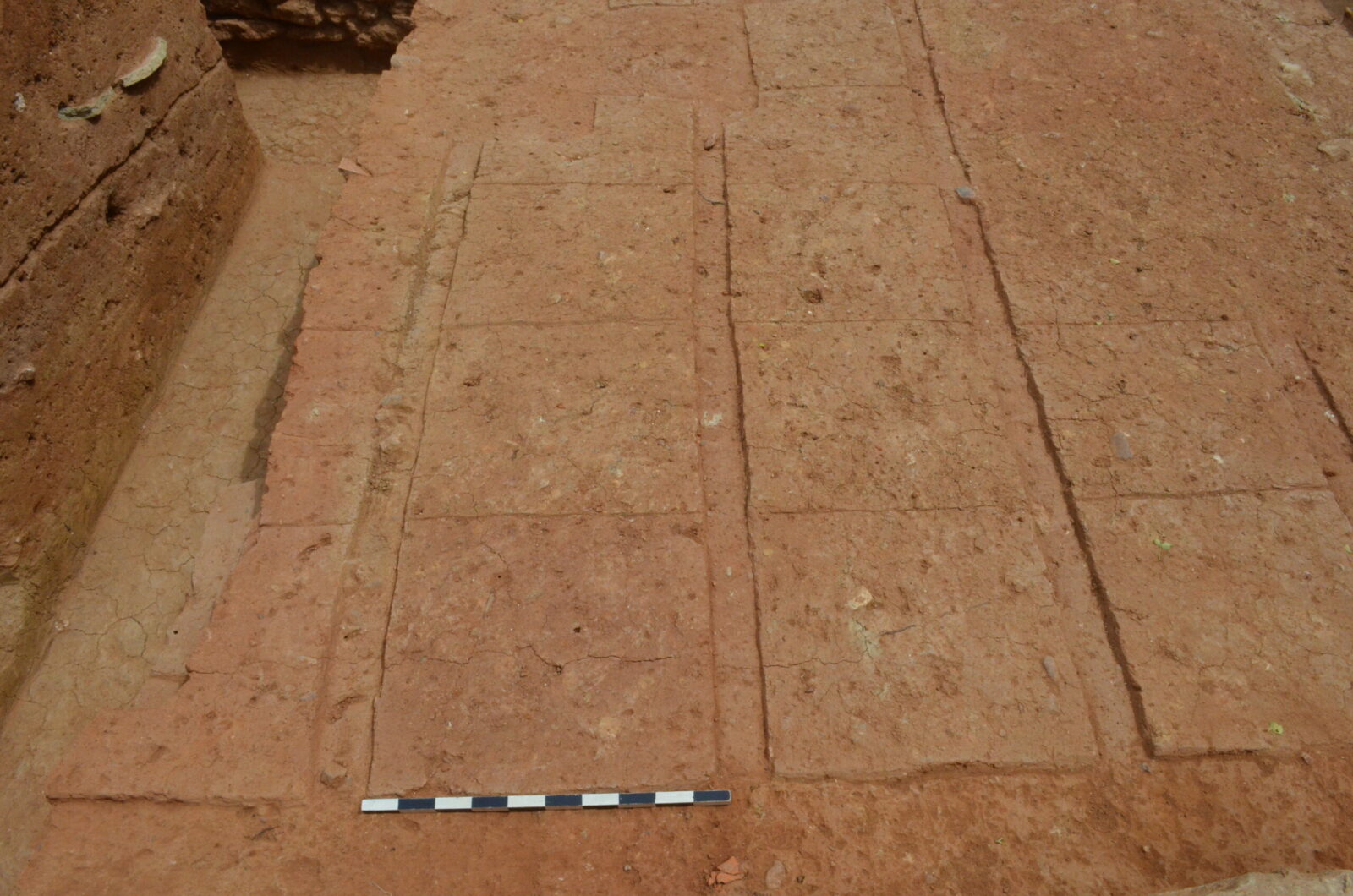
The mud-bricks are square in shape, measuring 0.47 by 0.47 m, 0.07-0.08 m thick. Along the course of the wall, they are adjacent, creating courses separated by joints ~0.08 m wide.
The part of the pure brick body rests on a layer of barren hard clay and at its southern end rests higher.
A construction joint 0.20 m wide is also formed between the pure brick body and the northern face of the tower.
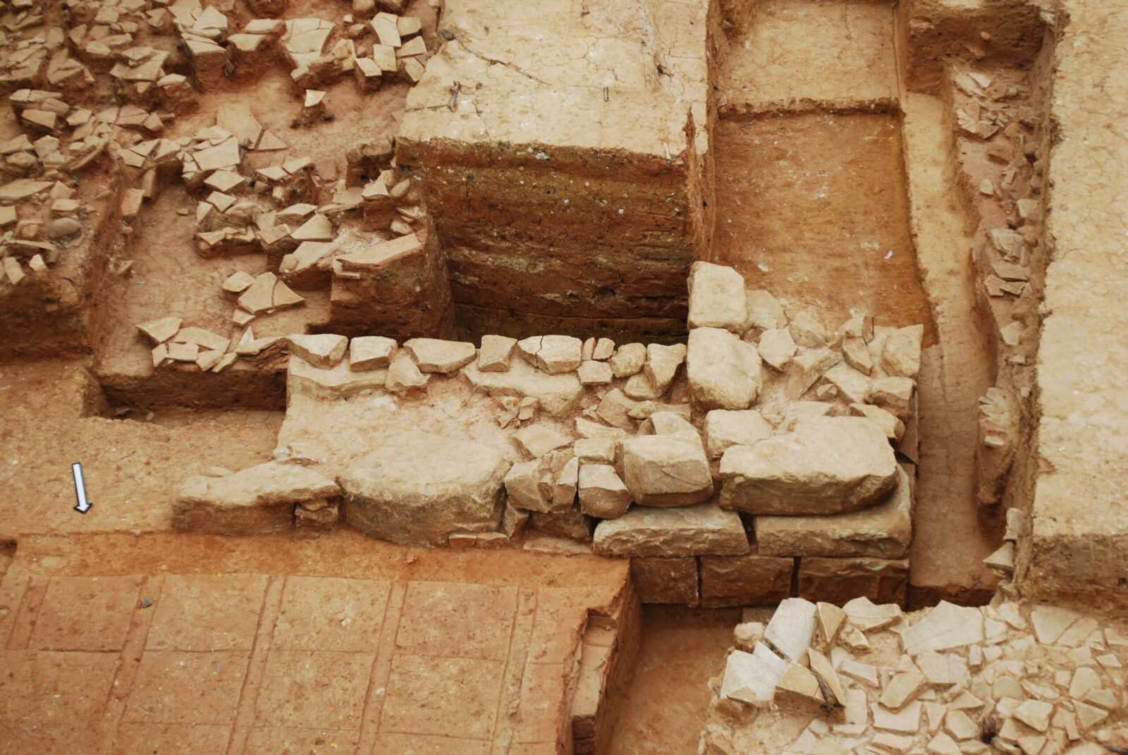
The north stone-built face of the tower (1.15-1.20 m wide, with a preserved length of 3 m) projects from the inner face of the wall by 1.20 m and is firmly linked with the western face (1.10 m wide, with a preserved length of 2.10 m). It is a strong structure of sandstone blocks following the irregular trapezoidal masonry mode with the wedging of slab plugs in the intermediate gaps. The sandstone blocks are laid in equal-height courses with their long sides horizontal and the narrow ones mostly inclined (sometimes inwards and sometimes outwards off the vertical axis), while some have one or two of their corners slightly cut off. The outer face of the blocks is roughly dressed.
The internal projection of a tower that protrudes from the front plane of the wall indicates the existence of an internal staircase for access to the parodos of the eastern branch or a ramp for the ascent of ballistic machines/catapults.
The towers of the fortifications protected not only the main gates but also the curving points of the wall-course.
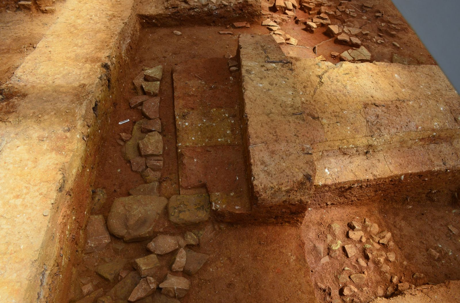
The stones surrounding the base of the tower, which come from its original fronting, do not adhere to the solid mud-brick core.
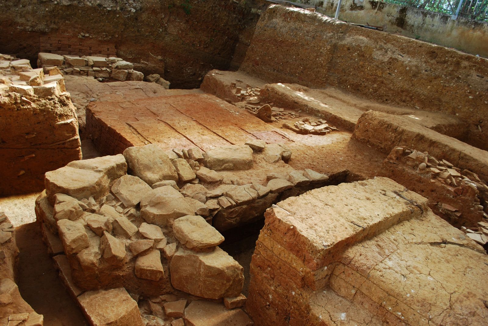
With the removal of part of the brick core of the tower, the northwestern inner corner of the stone fronts was revealed.
Along the wall, a dense destruction layer of roof tiles came to light.
Stamped roof tiles
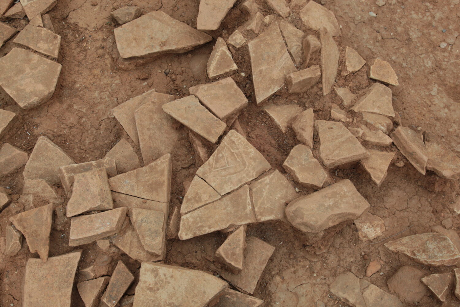
The existence of a tiled roof is a prerequisite for the protection and preservation of the brick wall from the dissolving effect of water. At all sites where parts of the wall were found, dense, extensive and often successive destruction layers were found, which mainly consisted of Laconian-type roof tiles. Stamped tiles bearing the initials of the city (ΔΥ) were collected from these layers, indicating the connection of the wall with the city’s security and independence, and making both its construction and maintenance a public concern. The large number of ceramic workshops in the city confirms the mass production of tiles required to shelter the parodos.
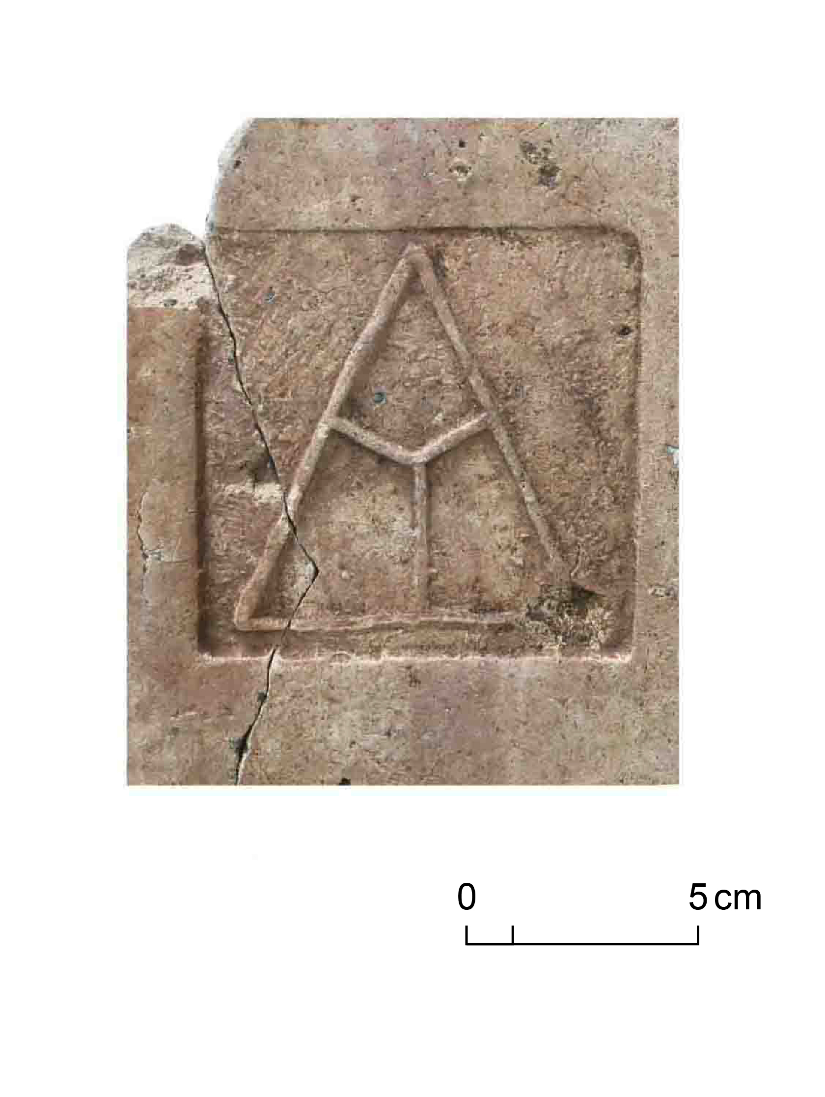
The widespread imprint of the ΔΥ monogram at the sites where the wall was found, but also on building remains with public features in the city and the broader area of the Chora (territory) of Dyme, indicates the public use of the seal. The monogram of Dyme constitutes its ethnic symbol or badge. It combines the initials of the name, where the Y is inscribed within the Δ with variations in the rendering of the monogram and the shape of the frame in which it fits (square, triangle, circle, ellipsoid) as the cities had more than one public seals with the same types and varying shapes. The monogram is simple in design and easy to grasp, stating the provenance with direct reference to Dyme and its broader Chora (territory).
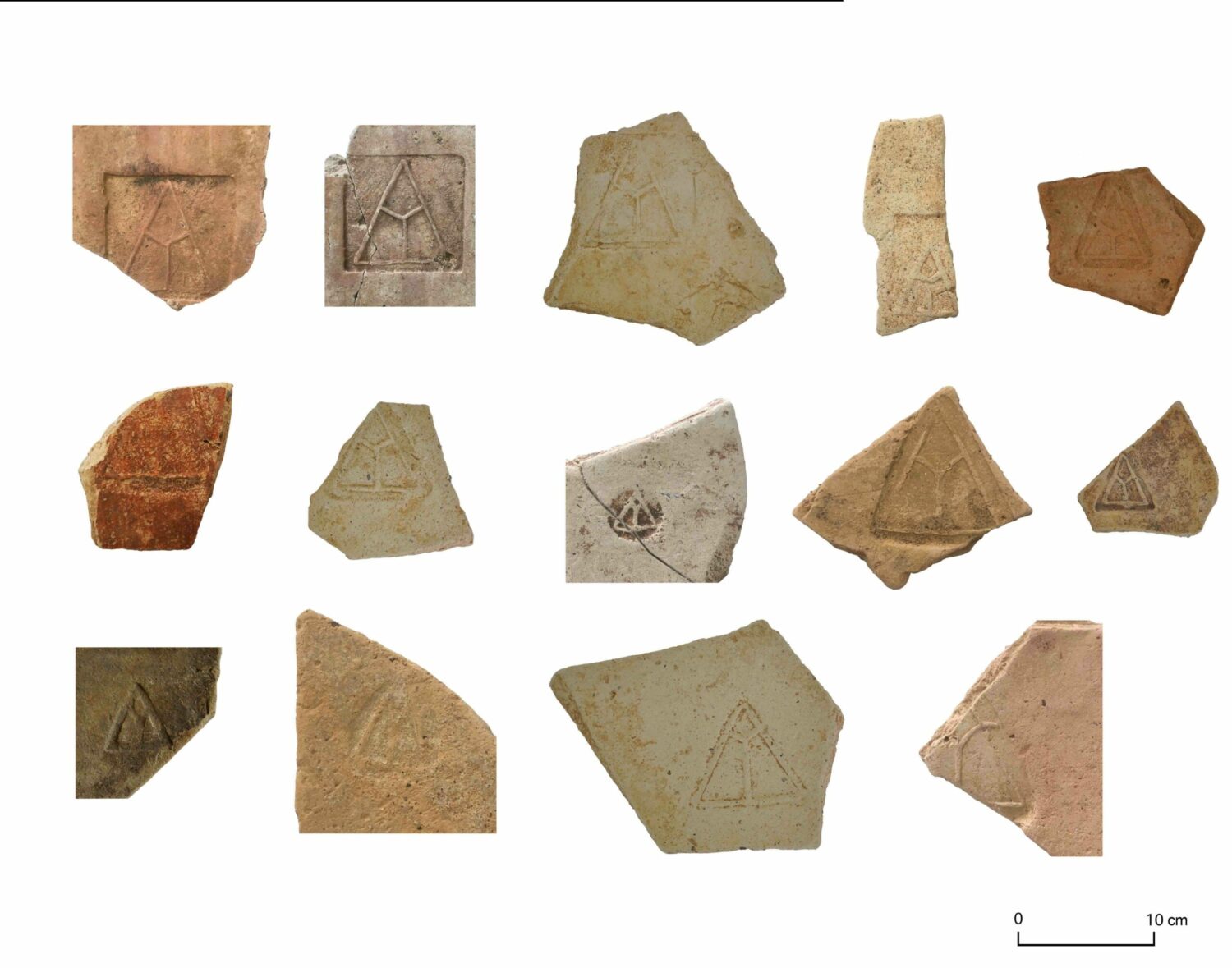
Roof tiles stamped with the monogram of Dyme.
Visible are the variations in the rendering and shape of the frame in which it is inscribed (square, triangle, circle and ellipsoid).
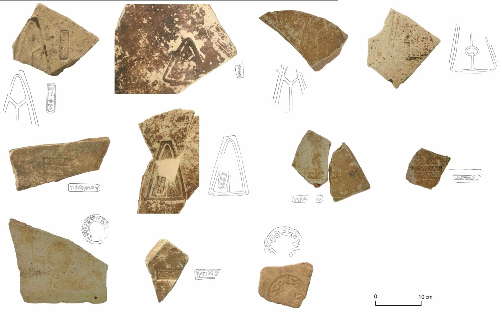
On the tiles of the wall, the monogram of Dyme coexists with the sealing of ΕΥΦΡΑ, ΠΡΑΥΛΟΥ and an illegible one. On a fragmentary preserved piece/sherd, the letters ΤΕΣ… are preserved within the monogram, while in another the letter Φ is inscribed.
The name ΕΜΠΕΔΟΞΕΝΟΥ is rendered with variations in its writing and the shape of the frame.
The names are considered to be indicative either of the manufacturers, who in this way made their products identifiable, or of the public officials who were in charge of the fortification project.
A fragment of a tile preserving this monogram was found in the core of the ceramic workshops of Dyme and confirms the public commissioning of production to potters on behalf of the city, which facilitated the control of the order by the public officer or served the needs of production or certification.
Epilogue
But the journey does not end here…
Walls have protected people for centuries, and brickwork masonry is a building element of the world’s defensive architectural heritage. The European policy of cultural convergence is the basis for the implementation of the European vision that respects and recognizes the national specificity in order to preserve the fertile elements of the national tradition, in harmony with modern living conditions. Today, in the spirit of bioclimatic architecture, it is imperative to re-evaluate natural, ecological and cost-effective materials, such as mud-bricks, as an alternative form of environmental constructions.
The acquaintance with the brick wall of Dyme offers the opportunity to explore various aspects of an ancient fortification project, such as function, structural materials, technical design, knowledge and skills involved in its construction, allowing the preservation of knowledge, its enrichment and its utilization today and the expansion of the perspective on the European horizon.
Vasiliki Tsaknaki
Archaeologist
Ephorate of Antiquities of Achaea
Sound track
Evanthia Reboutsika
Musician – Composer
Translation
Stella Dreni | Dr Elena Partida
Archaeologist – Numismatist | Archaeologist – Architecture Historian
Digital editing
Andreas Panagiotopoulos
Computer Science H.E.
Bibliography
V. Tsaknaki 2023, Το πλίνθινο τείχος της Δύμης, Athens University Review of Archaeology (AURA), 6, 241-315.